
A Week of Violent Weather And Heavy Rainfall
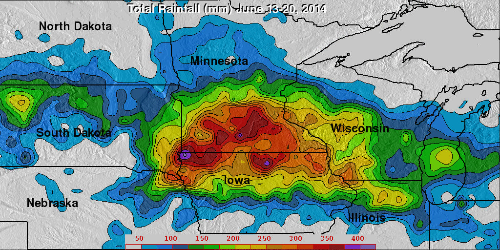
Over the past seven days stormy weather has spawned tornadoes and dropped extremely heavy rainfall in the Northern Plains and the Great Lakes states. This deluge has caused flooding in South Dakota, Minnesota, Iowa, Wisconsin and Illinios. There have been concerns about the Mississippi, Big Sioux and Rock River Rivers escaping their banks.
For more than sixteen years rainfall has been monitored by the TRMM-based, near-real time Multi-satellite Precipitation Analysis (TMPA) . These products have been developed at the NASA Goddard Space Flight Center by the precipitation research team. (TMPA) rainfall totals are shown for the period from 13 to 20 June 2014. Areas of rainfall totals greater than 100mm (about 4 inches) were found in areas from North Dakota to Indiana. The highest totals (light purple) of over 400mm (about 15.7 inches) were analyzed in northwestern Iowa.
Heavy rain amounts (from satellite data) and flood inundation calculations (from hydrological models) are updated every three hours globally with the results shown on the "Global Flood and Landslide Monitoring" TRMM web site pages.
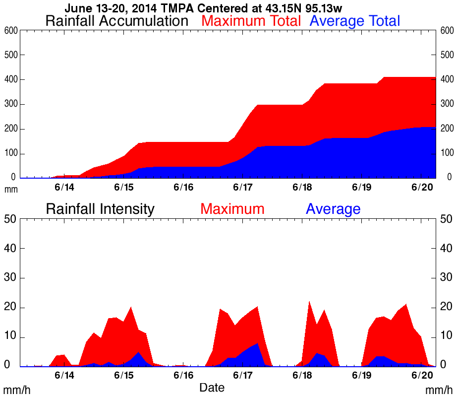
This graphs shows that during the past week rain was frequently falling at a rate of over 20mm/hr (about .8 inches) in northwestern Iowa. This graph shows the average and maximum rainfall measured by (TMPA) in this area.