Typhoon Jewalat Batters Japan
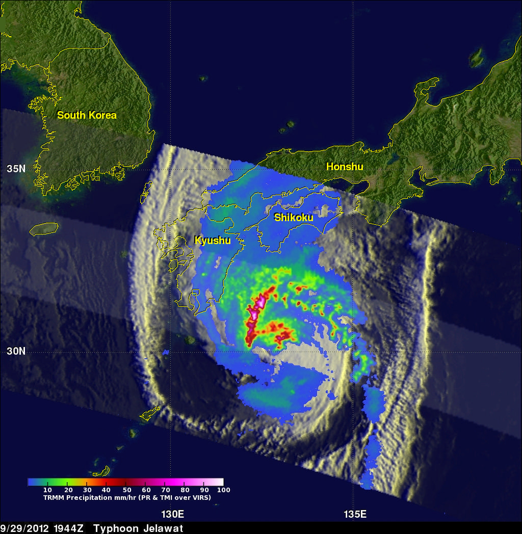
The TRMM satellite had an excellent look at typhoon Jelawat on September 29, 2012 at 1944 UTC. Jelawat had already battered Okinawa with 75kt (~87mph) winds and was headed for the main islands of Japan. An analysis of rainfall from TRMM's Microwave Imager (TMI) and Precipitation Radar (PR) instruments is shown overlaid on an enhanced infrared image from TRMM's Visible and InfraRed Scanner (VIRS). Rain is shown falling at a rate of over 90mm/hr (~3.5 inches) in strong feeder bands northwest of Jelawat's center of circulation. Jelawat was already causing light to moderate rainfall on the Japanese islands of Kyushu and Shikoku.
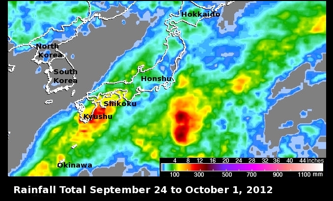
This TRMM-based, near-real time Multi-satellite Precipitation Analysis (TMPA) at the NASA Goddard Space Flight Center shows the rainfall totals associated with typhoon Jelawat from September 24 to October 1, 2012. The island of Kyushu had over 355mm (~14 inches) of rainfall in the past week.