Typhoon Haikui Heading Toward China

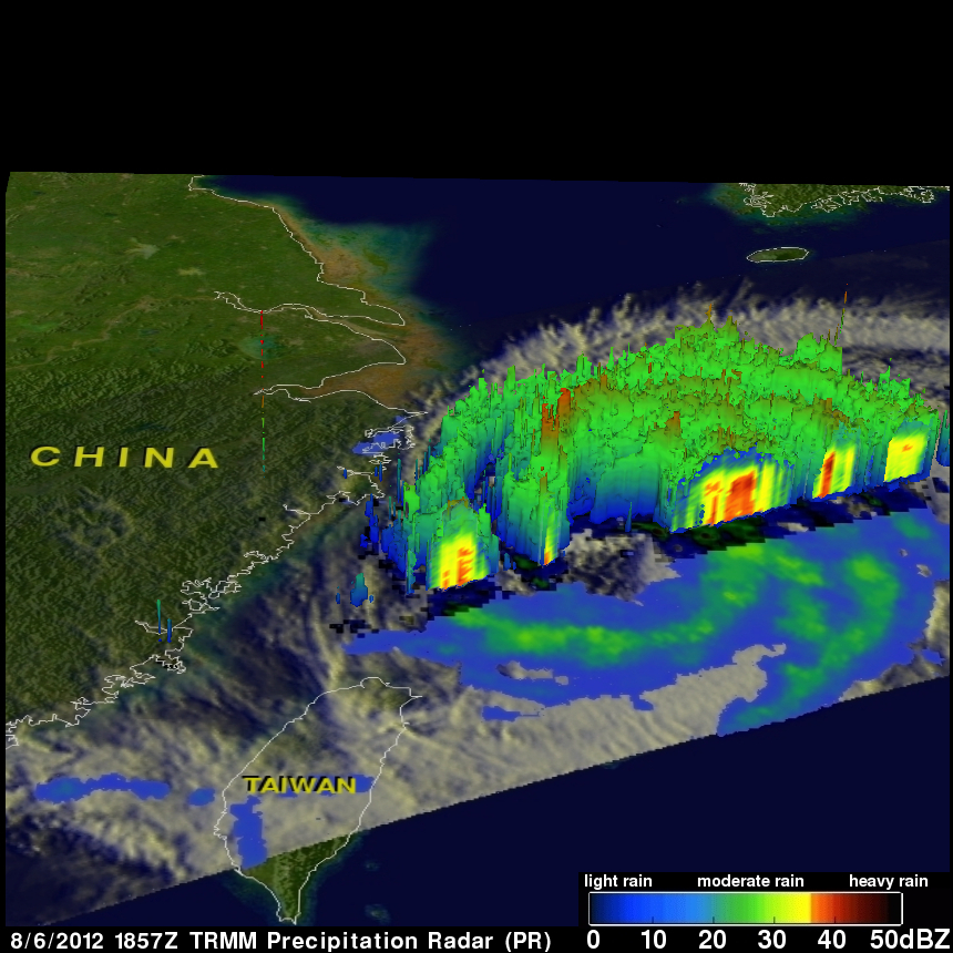
The TRMM satellite had a good view of Typhoon Haikui on August 6, 2012 at 1857 UTC as it was moving toward China. At that time Haikui was a category one typhoon on the Saffir-Simpson hurricane intensity scale with wind speeds of 65 kts (~75 mph). Data from TRMM's Microwave Imager (TMI) and Precipitation Radar (PR) instruments show bands of moderate to heavy rainfall around Haikui's large eye.
TRMM PR data were also used to show a 3-D cross section through Haikui's eye. This view shows that intense rainfall (45 dBZ) was occurring in the eastern side of Haikui's eye.
Typhoon Haikui weakened after this TRMM pass. Haikui is predicted to be a tropical storm with wind speeds of about 50kts (~58 mph) when it hits China on August 8, 2012 at 0000Z.