
Typhoon Bopha Threatens Philippines

At 0347 UTC today the TRMM satellite flew above a dangerous typhoon in the western Pacific Ocean called Bopha that is a threat to the Philippines. Bopha is predicted by the Joint Typhoon Warning Center (JTWC) to hit the island of Mindinao in the Philippines with winds of 135 kts (155 mph) later today.
The first image shows a satellite view of typhoon Bofa with rainfall from TRMM's Microwave Imager (TMI) and Precipitation Radar (PR) instruments overlaid on a visible/infrared image from TRMM's Visible and InfraRed Scanner (VIRS). This analysis shows that Bopha had a well defined eye with very heavy rain falling at a rate of over 80mm/hr (~3.1 inches) in the eastern side of the eye and in intense rain bands spiraling around the eye.
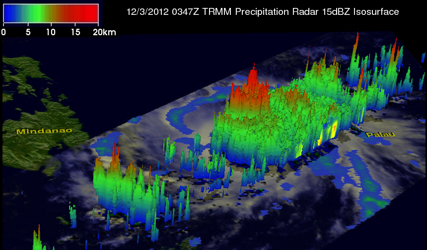
The 3-D image from TRMM's Precipitation Radar (PR) image shows that some strong convective thunderstorms on the eastern side of Bopha's eye were reaching heights of over 16km (~9.94 miles).