
Tropical Storm Philippe Shows Signs Of Life
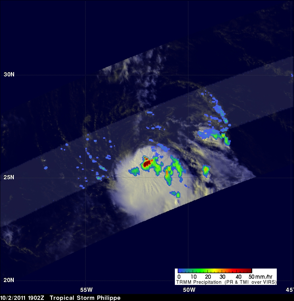
Tropical Storm Philippe, located in the central Atlantic Ocean, has shown signs of strengthening. The TRMM satellite obtained those data used in the above image when it passed over on 2 October 2011 at 1902 UTC ( 3:02 PM EDT). TRMM's Microwave Imager (TMI) and Precipitation Radar (PR) derived rainfall showed that Philippe had powerful thunderstorms in the north-central part of the storm dropping rainfall at a rate over 50 mm/hr (~2 inches).
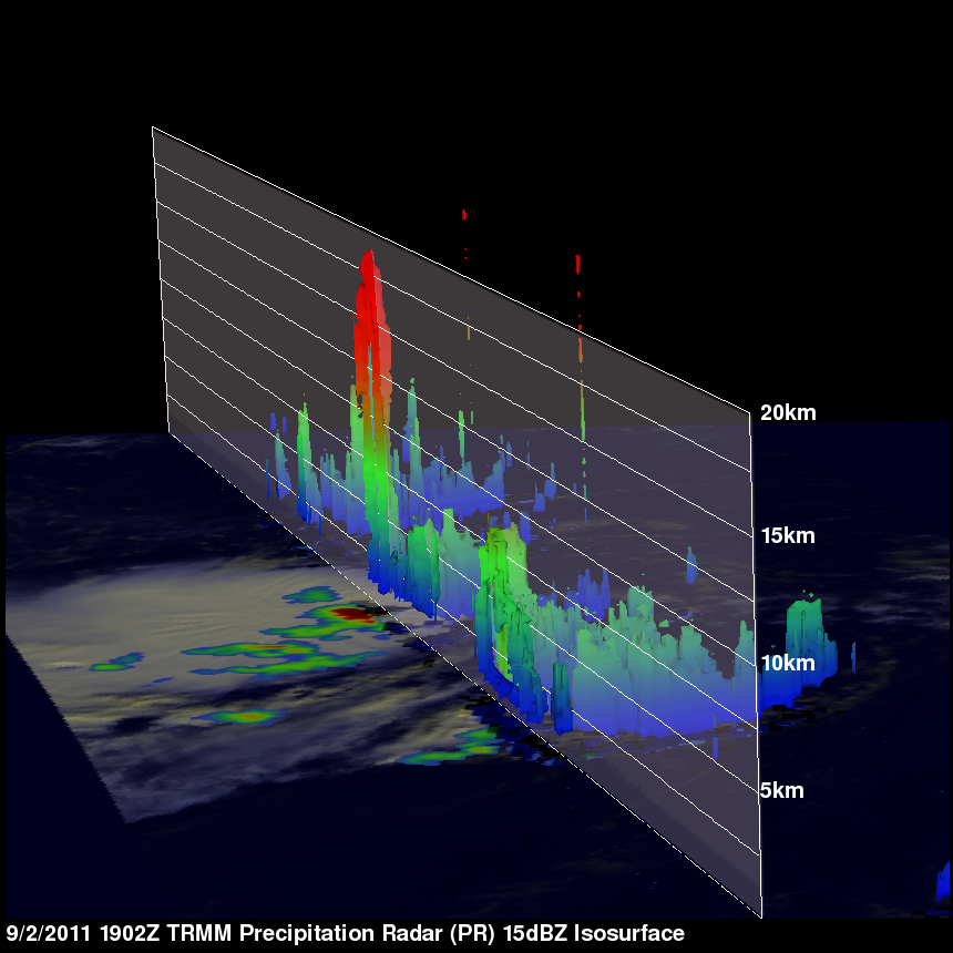
TRMM's PR was used in the image below show a vertical cross section (slice) through one of these thunderstorms. This image shows that one of these tall thunderstorm towers reached to heights above 17 km (~10.5 miles). Deep convective towers like this can be an indication of future intensification especially when they are located near the core of the storm.
The National Hurricane Center (NHC) has predicted that Philippe will strengthen slightly to just under hurricane intensity.