
Tropical Storm Lee Joins with Frontal System to Soak the Eastern US
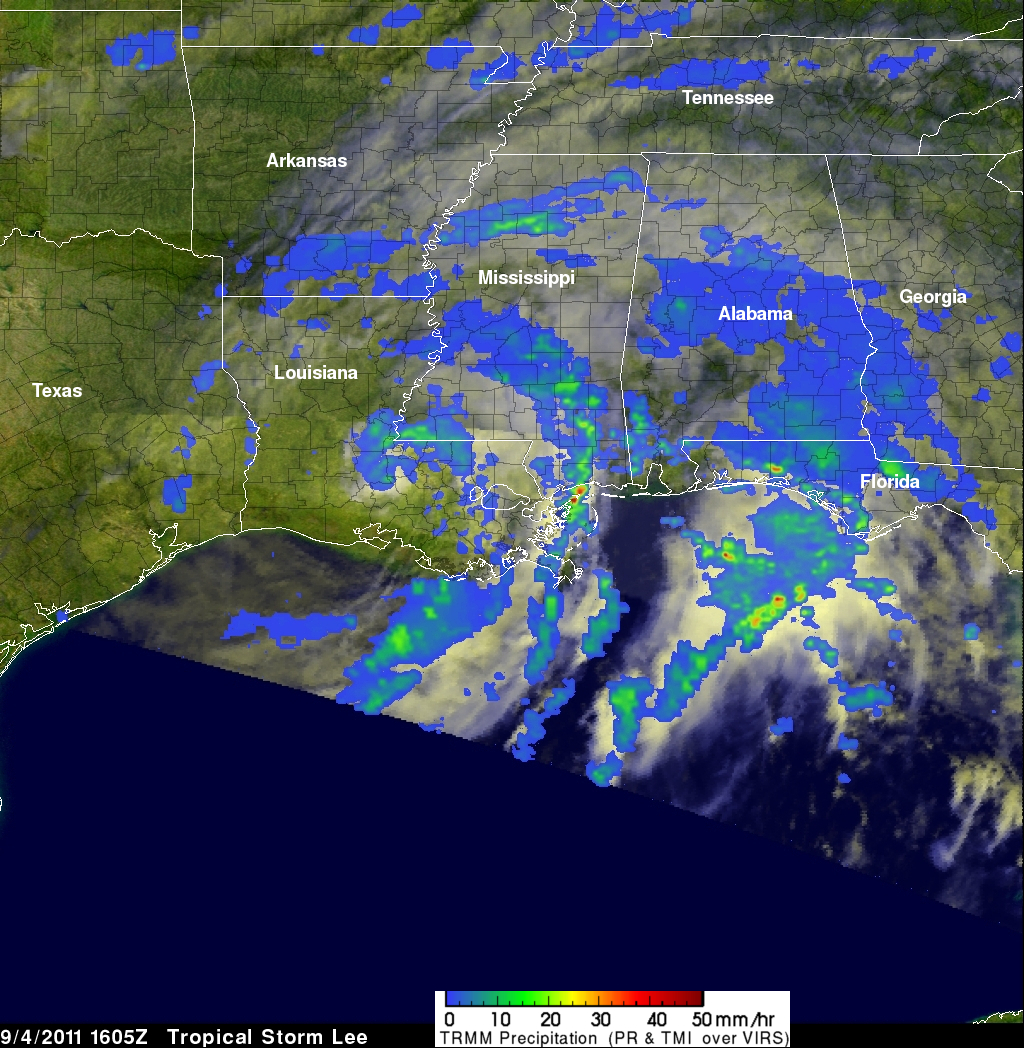
After forming in the north central Gulf of Mexico, Tropical Storm Lee came ashore over south central Louisiana on the morning of Sunday September 4th, 2011. Over the next two and a half days, the slow-moving storm worked its way across central Louisiana and central Mississippi and into northern Alabama, dumping heavy rains along the way. The primary mission of the Tropical Rainfall Measuring Mission or TRMM satellite is to measure rainfall over the global Tropics using a combination of passive microwave and active radar sensors. For expanded coverage, TRMM can be used to calibrate rainfall estimates from other satellites. Rainfall estimates from the TRMM-based, near-real time Multi-satellite Precipitation Analysis (TMPA) at the NASA Goddard Space Flight Center are shown here for the period 31 August to 8 September 2011 for the eastern half of the US. TMPA shows heavy rains extending inland from the northern Gulf of Mexico across eastern Louisiana, Mississippi, northwestern Alabama, and into central Tennessee. Rainfall totals in this region generally exceed 100 mm (~4 inches, shown in dark green) with some parts of Mississippi and Louisiana receiving upwards of 250 mm (~10 inches, shown in dark red). Chattanooga Tennessee broke their all time 24-hour rainfall total with 9.69 inches.
After coming ashore, Tropical Storm Lee began to merge with a slowing-moving frontal system advancing eastward out of the Mississippi valley. This frontal system was associated with a quasi-stationary upper-level low pressure center located over the Ohio valley. As a result, tropical moisture was drawn up the eastern seaboard, bringing heavy rains from the mid-Atlantic up into the northern Appalachians. TMPA rainfall totals of 125 mm (~5 inches, shown in bright green) to as much as 200 to 250 mm (~8 to 10 inches, shown in orange and red) extend from south central Pennsylvania up into central New York, where the Susquehanna River reached record flood levels in downtown Binghamton. Elsewhere across the mid-Atlantic, where pockets of rain exceed anywhere from 100 to 150 mm (~4 to 6 inches), numerous roads and streets were closed due to widespread localized flooding.
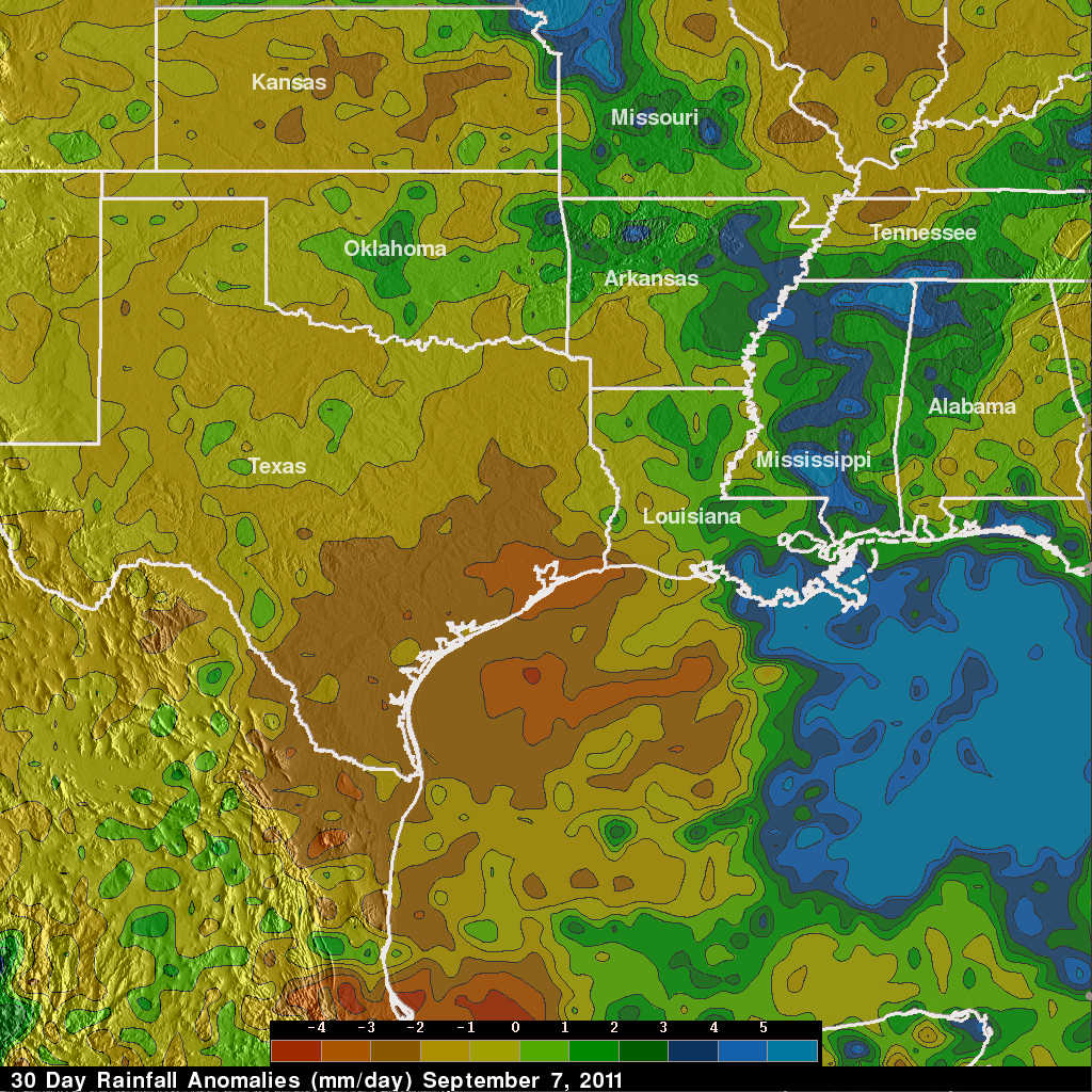
While much of the nation east of the Mississippi received too much rain, there was no relief for Texas and parts of the Central Plains, which remain locked in a drought. TMPA rainfall anomalies for the 1-month period 7 August to 7 September 2011 show above (areas in green) to well-above normal rain (areas in blue) along and east of the Mississippi due to the passage of Lee, while nearly all of Texas and most of Kansas are either below (yellow areas) or well-below normal (brown areas). The anomalies were constructed by computing the average rainfall rate over the period and then subtracting the 10-year average rate for the same period.