
Tropical Storm Don Approaching Texas
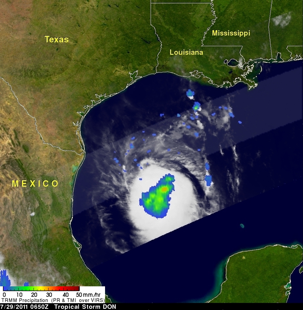
The TRMM satellite passed over tropical storm DON on 29 July 2011 at 0650 UTC (1:50 AM CDT) while the storm was in the Gulf Of Mexico. TRMM's Microwave Imager (TMI) data were used in the image on the right to show rainfall overlaid on an infrared image from TRMM's Visible and InfraRed Scanner (VIRS) instrument.
This image shows that DON had become larger and better organized since last seen by TRMM. Also the area of rainfall was larger with some moderate to heavy rainfall located near the storm's center.
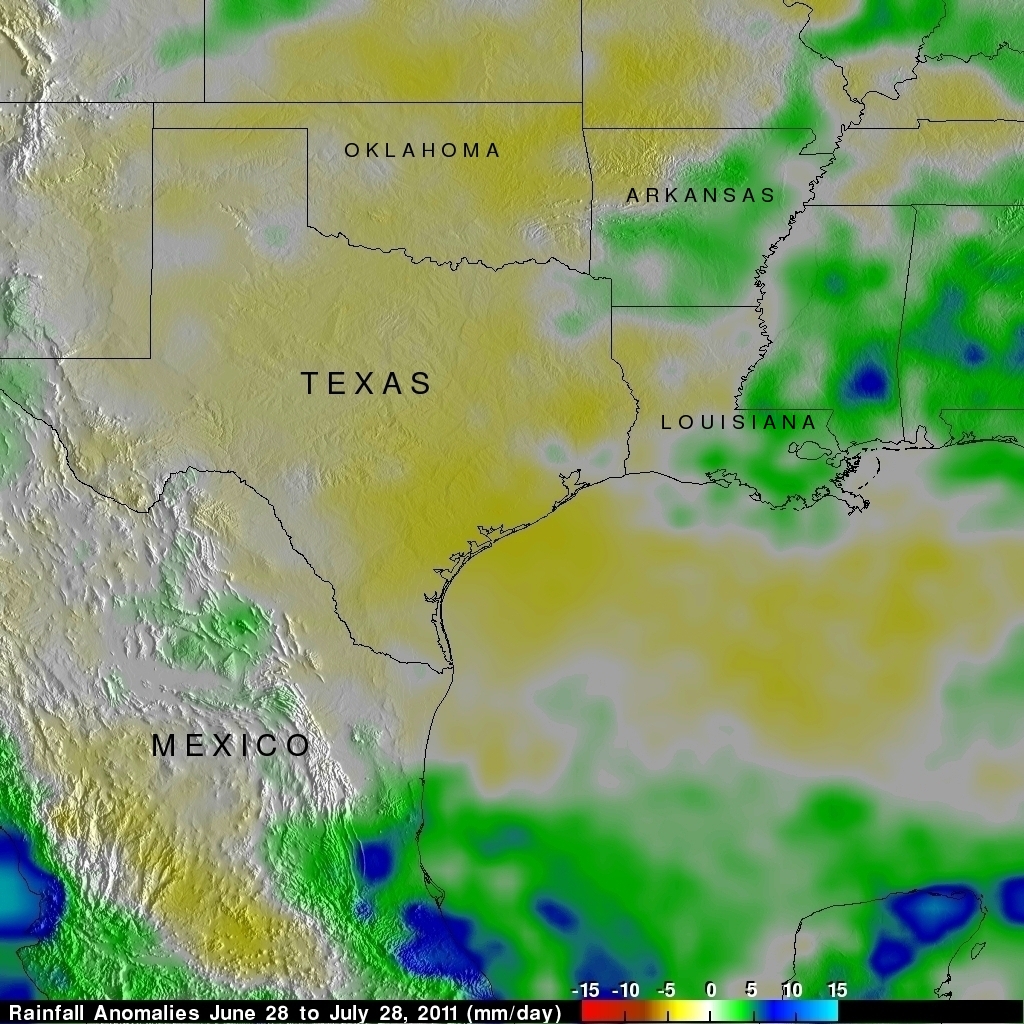
Texas has been suffering from extreme drought this year so DON's rainfall may provide some relief. TMPA rainfall anomalies for the past month are shown on the right. This analysis used near-real time Multi-satellite Precipitation Analysis (TMPA) data that were constructed by first computing the average rainfall rate over the period and then subtracting the 10-year average rate for the same period. This analysis indicates that some areas of Texas experienced rainfall that was at least 5 mm per day less than normal for the past 30 days. This means that the rainfall deficit was greater than 150 mm (~5.9 inches) for the past month in some areas.