
Tropical Storm Barry Forms & Makes Second Landfall
As predicted by the National Hurricane Center (NHC), tropical depression two strengthened in the Bay Of Campeche and became tropical storm Barry on Wednesday June 19, 2013 at 1:45 PM CDT (18:45 UTC). Barry's center of circulation made landfall today just north of Veracruz, Mexico between 1200 and 1300 UTC with 40kt(~46 mph) winds. The NHC has forecast that heavy rainfall from Barry "could cause life-threatening flash flooding and mud slides..."
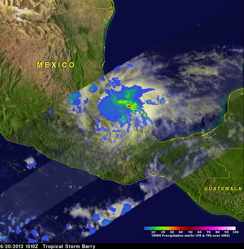
This image uses data captured when the TRMM satellite had a good view of tropical storm Barry on June 20, 2013 at 1510 UTC (10:10 AM CDT). A rainfall analysis from TRMM Microwave Imager (TMI) and Precipitation Radar (PR) data found rain falling at the rate of over 66mm/hr (~2.5 inches) in well defined bands spiraling from the Bay Of Campeche into tropical storm Barry's eastern side.