
Tropical Depression Banyan

The TRMM satellite collected data on 14 October 2011 at 0837 UTC that were used to make the images above of tropical depression Banyan (known as Ramon in the Philippines). Tropical storm Banyan was the latest killer cyclone to hit the Philippines this year following closely on the heels of typhoons Nesat and Nalgae. Banyan resulted in the reported deaths of at least nine people in the Philippines before weakening and moving into the south china sea as a tropical depression.
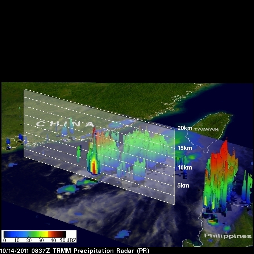
TRMM satellite data shows that Banyan, although small, contained some powerful convective storm near the center of the depression. TRMM's Precipitation Radar (PR) data indicates that a few of these storms reached heights of 15 km (~9.3 miles) with strong echoes showing reflectivity values of over 47 dBZ (decibels of Z). Values of reflectivity this high indicate that heavy rainfall was occurring at that time. These tall storms can be a sign of intensification.