
Tropical Cyclones In Three Oceans
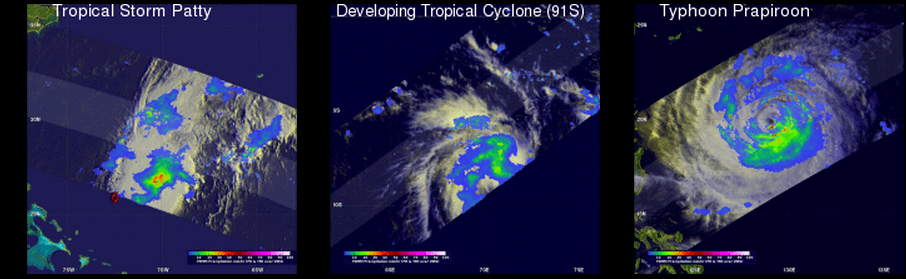
The TRMM satellite saw tropical cyclones in three ocean basins today. TRMM flew nearly above tropical storm Patty in the Atlantic Ocean northwest of the Bahamas first on October 12, 2012 at 0326 UTC. It was night so an enhanced infrared image from TRMM's Visible and InfraRed Scanner (VIRS) was overlaid with a rainfall analysis derived from TRMM's Microwave Imager (TMI) and Precipitation Radar (PR) instruments. Patty's location, close to the edge of the TMI swath, is shown with a red tropical storm symbol.
TRMM also viewed a developing tropical cyclone in the South-West Indian Ocean on October 12, 2012 at 0901 UTC. This was during the day in this part of the world so an enhanced visible and infrared image from TRMM's VIRS is shown overlaid with a precipitation analysis from TRMM TMI and PR data. The South-West Indian Ocean tropical cyclone season doesn't officially start until November 1, 2012 so this development is a little early.
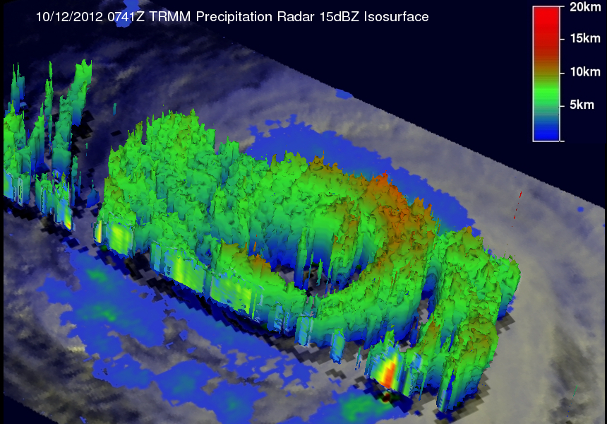
TRMM passed directly above weakening typhoon Prapiroon in the western Pacific Ocean on October 12, 2012 at 0741 UTC. Typhoon Prapiroon was a powerful category two typhoon on the Saffir-Simpson scale with winds slightly less than 95 kts (~109 mph). The perspective 3-D image above was made using data from TRMM's Precipitation Radar (PR) instrument. This view from the northwest clearly shows the vertical structure of Prapiroon's precipitation. The highest reflectivity value of 49.98 dBz was found in the southern side of Prapiroon's eye wall. This image reveals that the northern side of Prariroon's eye had eroded.