
Tropical Cyclone Thane Hits India
At least 33 people were killed when tropical cyclone Thane with reported winds of up to 85 mph hit the southeastern coast of India Friday morning. The TRMM satellite saw the tropical cyclone several times from it's birth in the Bay of Bengal to it's strengthening to hurricane force before penetrating the Indian coast.
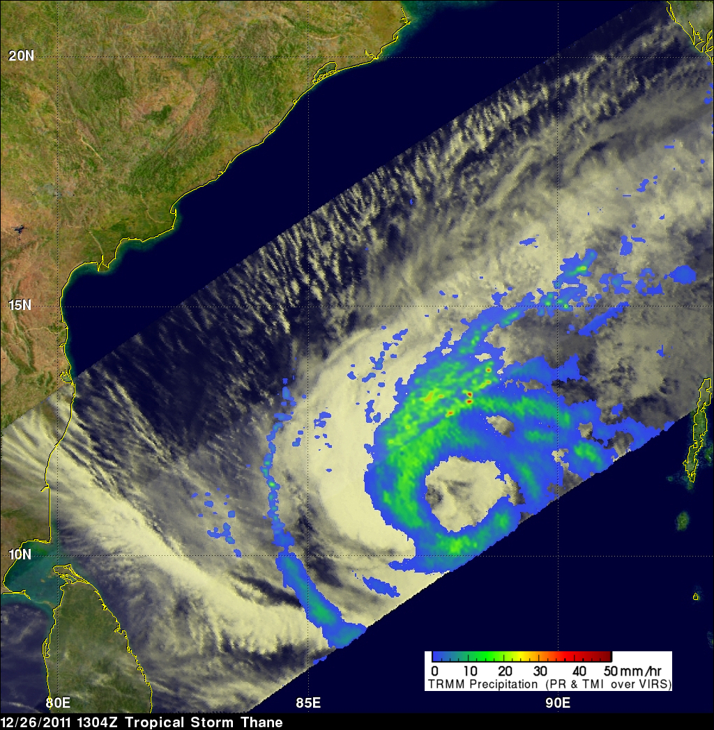
Thane was a tropical storm with winds of about 40kts when TRMM passed above on 26 December 2011 at 1305 UTC. The storm was starting to organize with TRMM Precipitation Radar (PR) revealing a large area of powerful storms surrounding the northern side. A TRMM Microwave Imager (TMI) rainfall analysis showed a large nearly circular eye like structure near the storm's center.
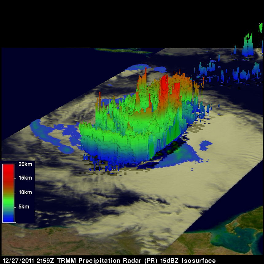
TRMM had another good look when Thane was strengthening on 27 December 2011 at 2159 UTC. TRMM PR showed continuous bands of intense convective storms occurring within bands around Thane. Some of these storms were returning values of over 50 dBZ to TRMM's Precipitation Radar (PR) instrument proving that heavy rainfall was falling in that area. The 3-D image above was made from TRMM PR data. It shows that some convective thunderstorm towers were reaching to heights of over 16km (9.94 miles).
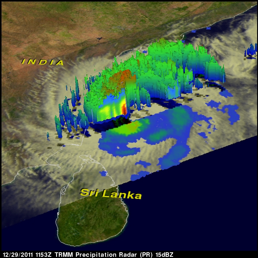
Thane was a hurricane force tropical cyclone with winds of about 75 kts (~86 mph) when the TRMM satellite again checked on 29 December 2011 at 1153 UTC. TRMM PR showed multiple bands of intense convective storms southwest of Thane's center off the coast of India. Some of the rain in these very powerful storms were returning reflectivity values of over 55dBZ again giving proof of heavy rainfall. TRMM's Precipitation Radar (PR) data were again used to show the 3-D structure within Thane in the image above.