
Tropical Cyclone Anais (01S) Intensifying
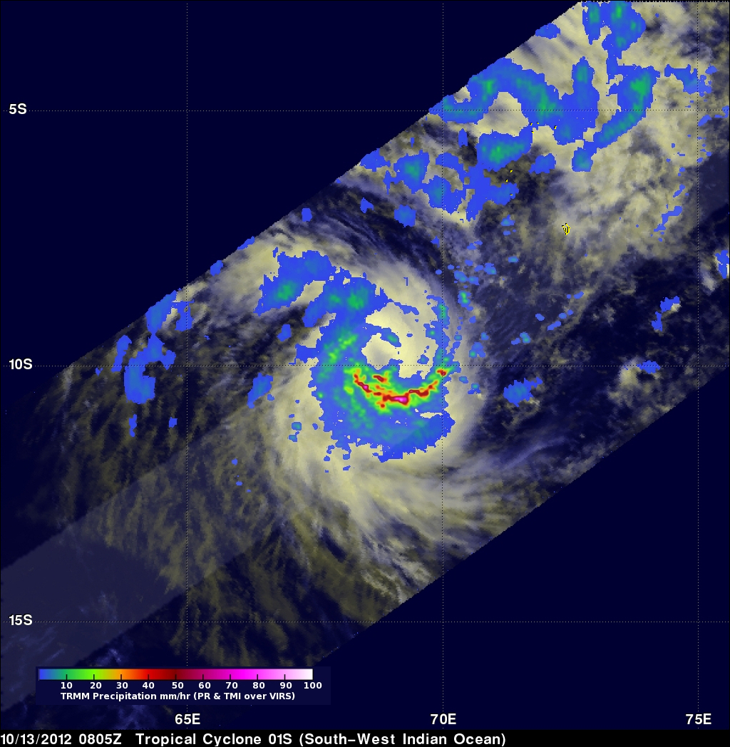
The first tropical cyclone of the 2012 South-West Indian Ocean season called Anais formed northeast of Madagascar yesterday. The TRMM satellite saw Anais on October 13, 2012 at 0805 UTC (~12:05 PM Local). TRMM's Microwave Imager (TMI) and Precipitation Radar (PR) rainfall are shown on the right. Intense bands of rain are shown spiraling around the southern side of the intensifying tropical cyclone.
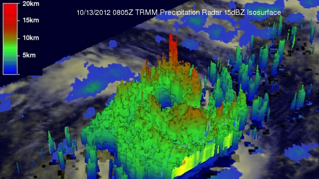
TRMM's Precipitation Radar (PR) data were used to make the 3-D perspective image above. It shows that Anais' had a developing eye wall containing towering thunderstorms reaching an altitude of 15km (~9.3 miles). Within 48 hours Anais is predicted to intensify and become a category one tropical cyclone on the Saffir-Simpson hurricane wind scale. Tropical cyclone Anais is headed southwestward and is predicted to approach Madagascar within five days.