
TRMM's Sees Deadly Ian Hitting Tonga
Tropical cyclone IAN meandered in an area of the Pacific Ocean between Fiji and Tonga as it intensified from tropical storm intensity with winds of 35kts (~41 mph) on January 5, 2014 to a deadly tropical cyclone with winds of 125kts (~144 mph) on January 11, 2014. Tropical cyclone IAN caused extensive damage and an unknown number of deaths when it passed through Tonga at the peak of it's intensity.
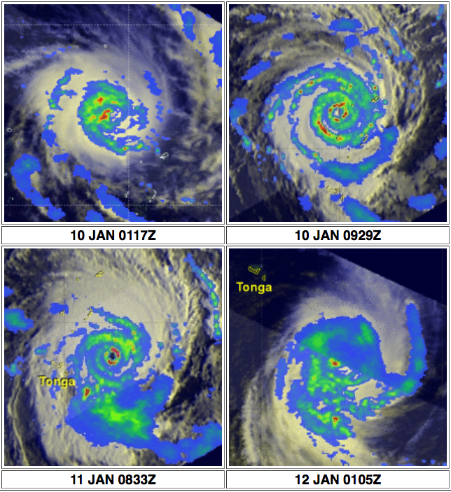
The TRMM satellite provided excellent coverage of IAN with multiple passes directly above the tropical cyclone. Rainfall data collected by TRMM's Microwave Imager (TMI) and Precipitation Radar (PR) instruments with four passes are shown overlaid on the images above. The first image on the upper left on January 10, 2014 at 0117 UTC shows IAN between Fiji and Tonga with sustained winds estimated at 90kts (~104 mph). The image on the upper right on January 10, 2014 at 0833 UTC shows that a little over 8 hours later IAN was much better organized with a very well defined eye. The image on the lower left uses data captured again when IAN was passing close to the east of Tonga on January 11, 2014 at 0833 UTC. IAN was then at it's most dangerous category four intensity with TRMM data showing rain falling at the rate of over 169 mm/hr (~6.7 inches) around the nearly circular eye. The final view on the lower right shows IAN after the still powerful tropical cyclone had moved to the southeast of Tonga on January 12, 2014 at 0105 UTC.
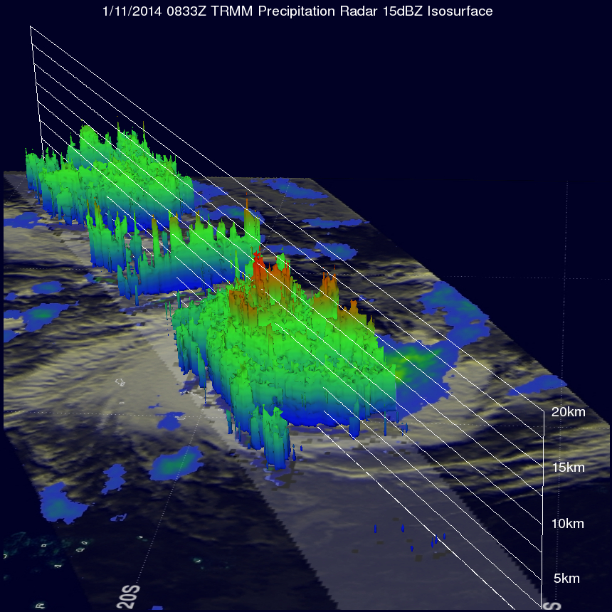
TRMM's Precipitation Radar (PR) instrument collected data used to show this 3-D view of IAN's well defined eye on January 11, 2014 0833 UTC. Powerful thunderstorms in IAN's eye wall were found reaching heights of about 15km (~9.3 miles).