
TRMM Views Tropical Cyclone Jasmine
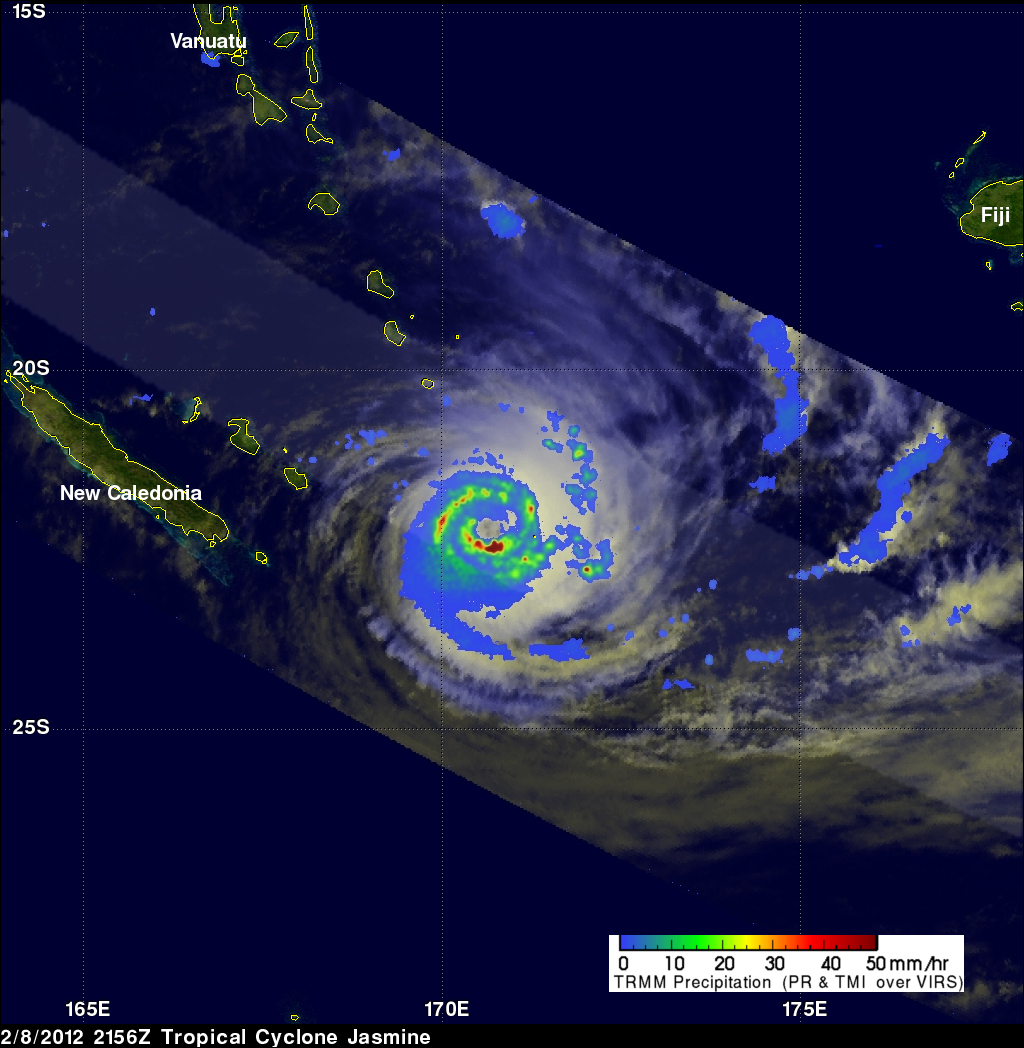
The TRMM satellite traveled directly above tropical cyclone Jasmine in the south Pacific Ocean on 8 February 2012 at 2156 UTC. Jasmine was classified as a powerful category 4 on the Saffir Simpson Scale with wind speeds of 115 kts (~132 mph) at it's peak intensity but had started to weaken at the time of this pass. Rainfall from TRMM's Microwave Imager (TMI) and Precipitation Radar (PR) instruments showed that intense storms in bands around Jasmine's large circular eye were dropping rainfall at a rate of over 50mm/hr (~2 inches). This was a daytime pass so the rainfall analysis was overlaid on a visible/infrared image from TRMM's Visible and InfraRed Scanner (VIRS) instrument. Lower visible clouds can be distinguished from higher clouds because they are yellower in this combination image.
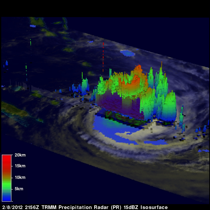
The 3-D image just above is from TRMM's Precipitation Radar (PR). This cutaway image reveals the funnel shaped surface of Jasmine's inner eye wall. TRMM PR data also shows that heights of Jasmine's tallest storms then reached to heights of about 11.5 km (~7.1 miles).
Click here to see a 3-D flyby of this image.