
TRMM Used to Examine the Bay of Bengal Tropical Cyclone
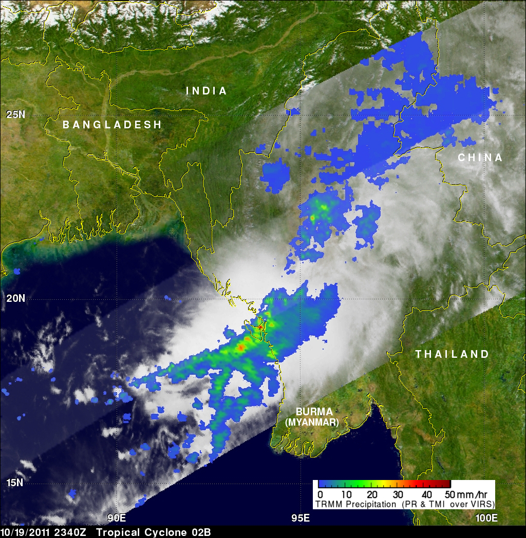
The accurate measurement of the tropical rainfall around the globe is one of the main objectives of the TRMM satellite. The TRMM satellite has also proven useful for global monitoring of tropical cyclone development. The images above were made from data received by the TRMM satellite when it passed over tropical cyclone 02B in the eastern Bay Of Bengal on 19 October 2011 at 2340 UTC. The image above shows a rainfall analysis that was made from TRMM's Microwave Imager (TMI) and Precipitation Radar (PR) data. It shows that moderate to heavy rainfall associated with 02B was extending northeastward from the eastern Bay Of Bengal into Burma (Myanmar).
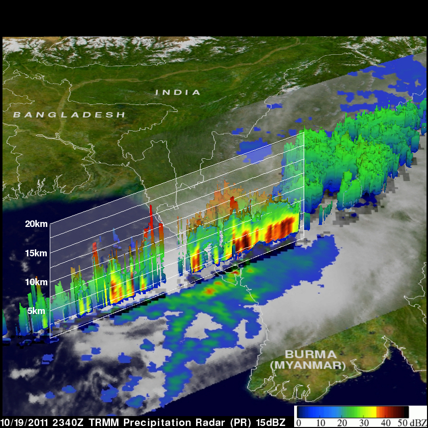
TRMM's Precipitation Radar (PR) has frequently been used to gather high resolution three-dimensional maps of rain within tropical cyclones. The image on above shows a 3-D slice through tropical cyclone 02B with Precipitation Radar data from that orbit revealing that it contained reflectivity values of over 45 dBZ. High reflectivity values like this indicate that heavy rainfall was occurring at that location. Some thunderstorms in the area of the cross-section were also shown to reach to heights of over 16 km (~9.94 miles).