
TRMM Sees Weakening Tropical Storm Keila
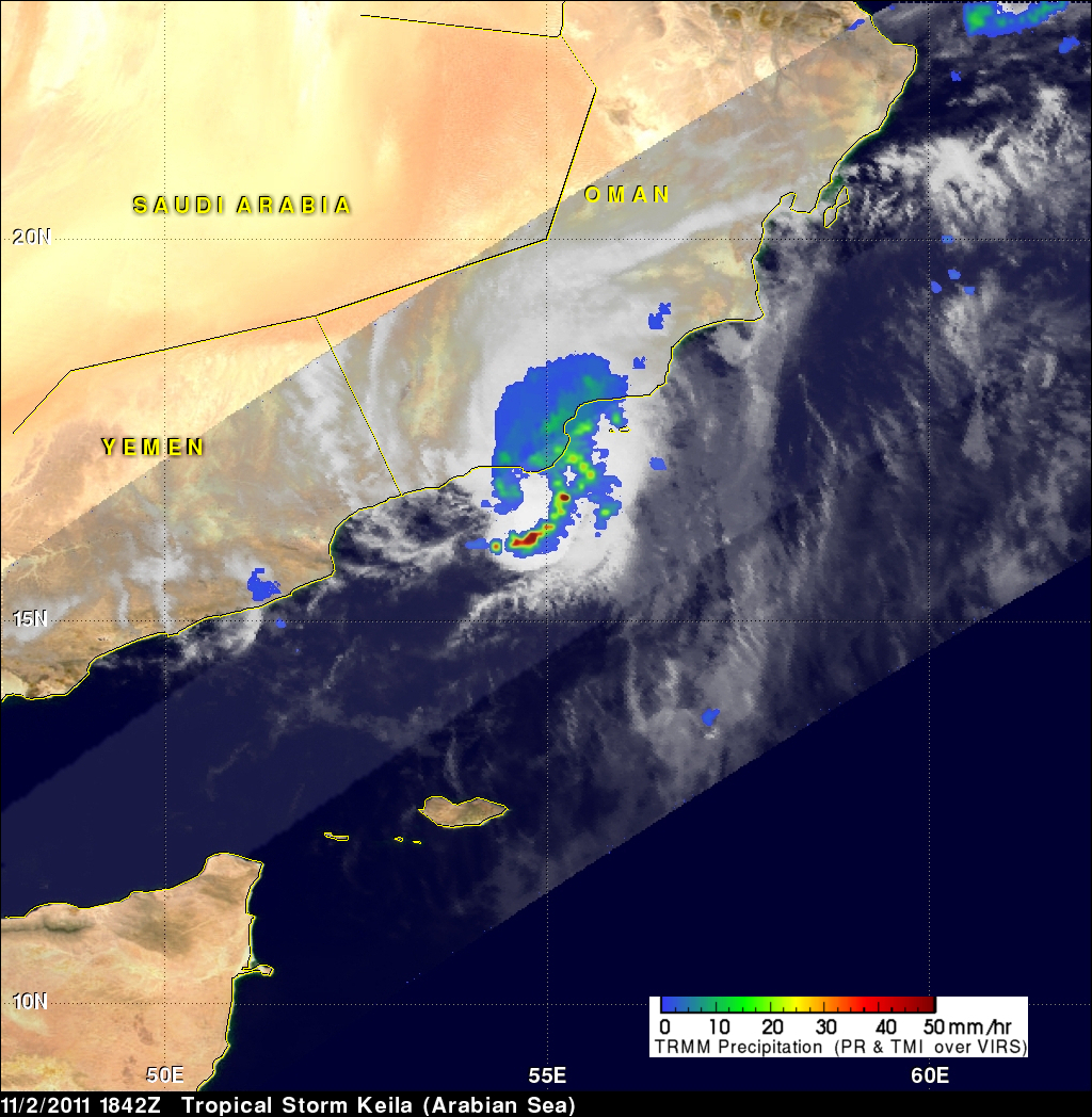
The TRMM satellite again flew over tropical storm Keila in the Arabian Sea on November 2, 2011 at 1842 UTC. Data received with that orbit shows that although Keila was weakening it was still producing some very powerful storms off the coast of Oman. A rainfall analysis from TRMM's Microwave Imager (TMI) and Precipitation Radar (PR) indicates that these storms were dropping rain at a rate of over 50mm/hr (~2 inches).
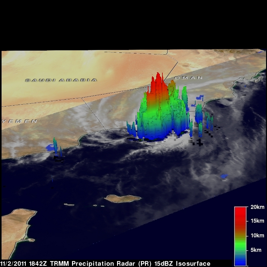
TRMM PR data were used in the image above to show the 3-D vertical structure of those storms. Some extremely powerful storms in the band of rainfall off the coast of Oman were shown to reach to heights of about 17km (~10.6 miles). Click here to see an animation that compares this later 3-D TRMM PR analysis to data from earlier in the day.