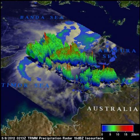
TRMM Sees Tropical Cyclone 19S
Tropical cyclones are more likely to form in the northern hemisphere in May so tropical cyclone 19S is a little unusual. Tropical cyclone 19S attained tropical storm intensity in the Banda Sea on 7 May 2012. 19S is expected to quickly weaken to tropical depression intensity with wind speeds of about 25 kts (~29 mph) as it moves southward into the Timor Sea north of Australia.
The TRMM satellite has been useful for monitoring the development of tropical cyclones over the global tropics. TRMM flew above tropical cyclone 19S during the daylight on 8 May 2012 at 0213 UTC. A rainfall analysis from TRMM's Microwave Imager (TMI) and Precipitation Radar (PR) data revealed that some storms in the area of 19S cyclone were dropping rainfall at a rate of over 50 mm/hr (~2 inches). The image above, that used data from TRMM's Precipitation Radar (PR), shows a 3-D view of the tropical cyclone's structure . The strongest thunderstorms in this area were shown by TRMM PR to be reaching heights of about 15km (9.3 miles).


