TRMM Sees TD13 Forming
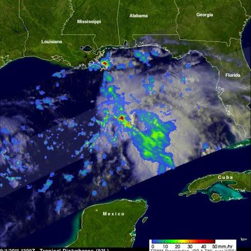
The TRMM satellite viewed the thirteenth tropical depression of the Atlantic hurricane season on Thursday 1 September 2011 at 1309 UTC (9:09 AM EDT) when it was still forming. The National Hurricane Center (NHC) has predicted that TD13 will intensify and become a tropical storm (Lee) today. The tropical storm is predicted by the NHC to slowly move toward the northwest and cause heavy rainfall over the states along the northern Gulf Of Mexico's coast.
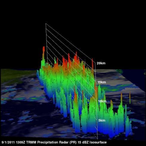
One area of heavy rainfall in the middle of the Gulf Of Mexico was in the center of the area viewed by TRMM's Precipitation Radar (PR). Some of the highest thunderstorm towers in the forming tropical depression were shown by PR data to reach heights of over 15km (~9.3 miles)


