
TRMM Sees Potential Tropical Cyclone
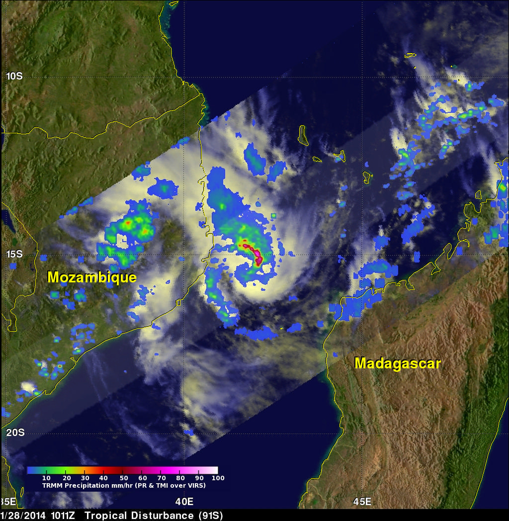
The TRMM satellite flew above a tropical low (91S) in the Mozambique Channel on January 28, 2014 at 1011 UTC. TRMM data collected with this pass may be helpful in evaluating this low for possible tropical cyclone formation. An analysis of rainfall from TRMM's Microwave Imager (TMI) and Precipitation Radar (PR) instruments are shown on the left overlaid on a visible/infrared image from TRMM 's Visible and InfraRed Scanner (VIRS). TRMM PR measured rain falling at the rate of over 134.9 mm/hr (about 5.3 inches) in a band of powerful convective thunderstorms north of the center of circulation.
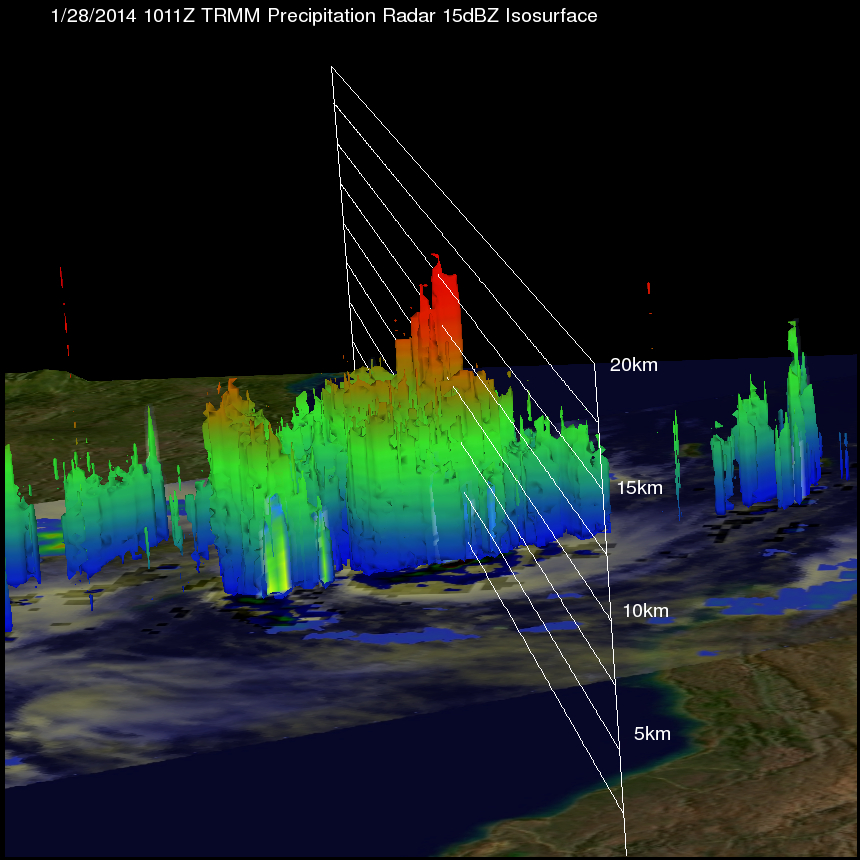
A 3-D view using TRMM PR data shows that some towering storms near the center of the low were reaching heights of above 16km (about 9.9 miles). Towers this tall near the center of the tropical low are often an indication of tropical cyclone formation or intensification.
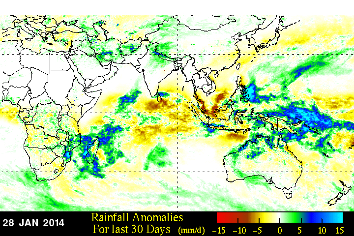
A rainfall anomaly analysis was made by comparing rainfall data compiled during the twelve year period from 2001-2012 to "near real-time" Multi-satellite Precipitation Analysis (TMPA-RT 3B42RT) data collected for the thirty day period ending on January 28, 2014.
Only one named tropical cyclone called DELIWE has passed through the Mozambique Channel so far this year but this analysis found that areas of the Mozambique Channel from southeastern Mozambique through western Madagascar have already had well above normal rainfall for the past 30 days.