TRMM Sees Gabrielle Closing In On Bermuda
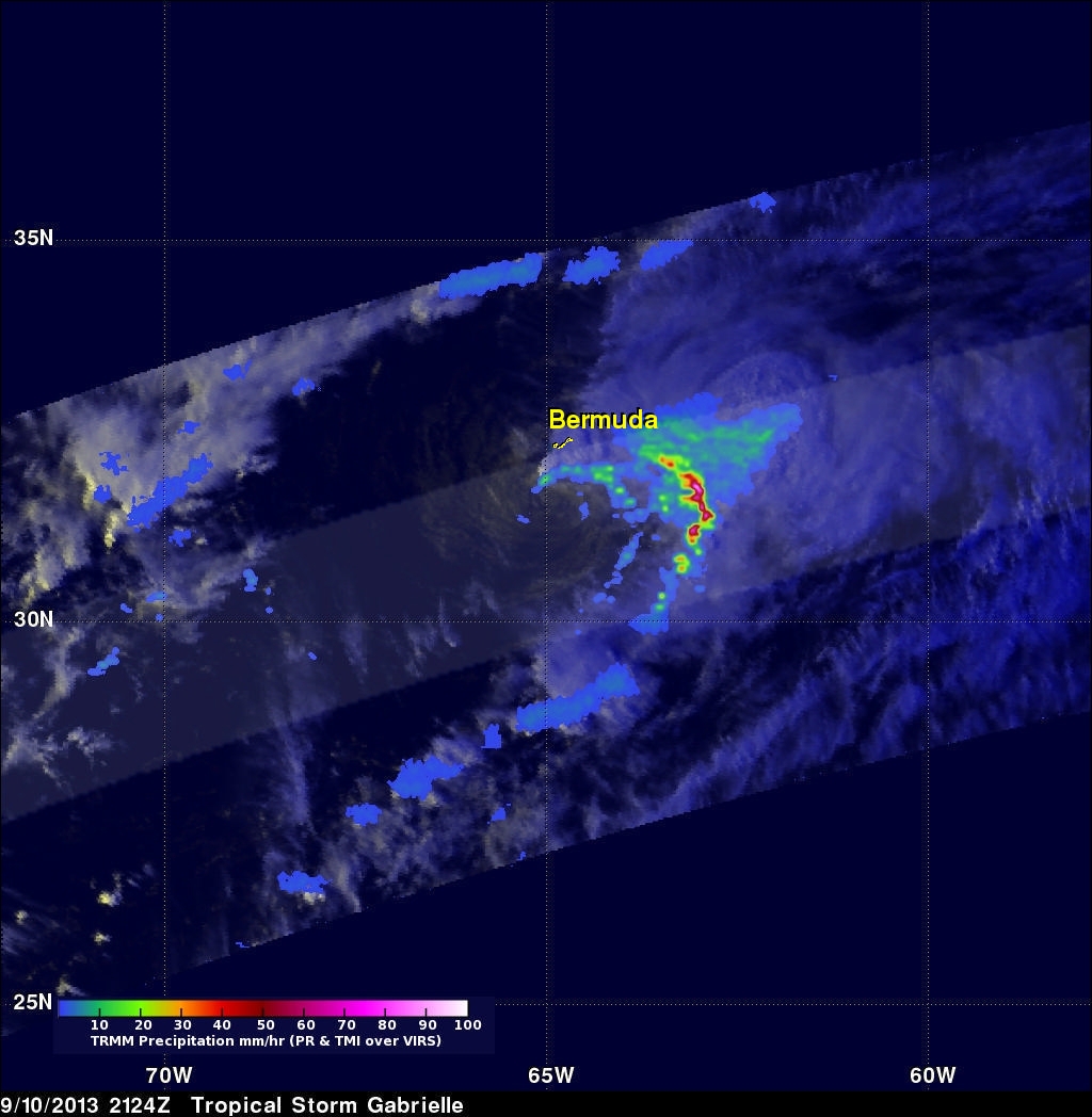
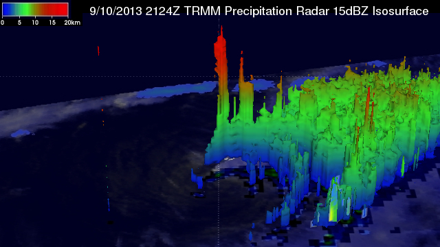
The TRMM satellite flew directly above tropical storm Gabrielle on September 10, 2013 at 2124 UTC (5:24 PM EDT) as the storm approached Bermuda. TRMM's Precipitation Radar (PR) data found that rain was falling at a rate of over 127mm/hr (~5 inches) in a line of intense storms southeast of Bermuda. TRMM PR also found that the tallest thunderstorms, reaching to heights above 15.5km (~9.6 miles), were located in an area close to Gabrielle's center of circulation.
Click here to see a simulated 3-D (Quicktime) flyby animation over Gabrielle approaching Bermuda using TRMM PR data.
Click here to see a simulated 3-D (MPEG) flyby animation over Gabrielle approaching Bermuda using TRMM PR data.