
TRMM Sees First Tropical Storm Forming In The South Indian Ocean
On 4 December 2011 at 1210 UTC The TRMM satellite had a look at the first tropical storm forming in the Indian Ocean this season. Tropical cyclones normally form in this area between 15 November and 30 April so this one was a little overdue. The "top down" view above shows a rainfall analysis from TRMM Microwave Imager (TMI) and Precipitation Radar (PR) overlaid on an enhanced infrared image from Visible and InfraRed Scanner (VIRS) data. This analysis shows that very heavy rainfall of over 50 mm/hr (~2 inches) was occurring in the forming tropical cyclone near the center of it's circulation.
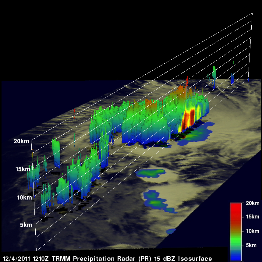
TRMM's Precipitation Radar (PR) data, shown in the 3-D image above, reveals that a few powerful storms near the storm's center were pushing up to heights of over 12 km (~7.45 miles). The release of energy within these tall towers are often a sign that a storm is intensifying.