
Philippine's Tropical Cyclone Rainfall 2013
In a normal year 30% of the total rainfall near the Philippines (northwestern Pacific Ocean) is caused by tropical cyclones. The most notable tropical cyclone this year was deadly super typhoon HAIYAN that devastated the central Philippines in November 2013.
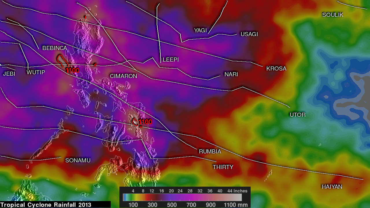
The TRMM-based, near-real time Multi-satellite Precipitation Analysis (TMPA) at the NASA Goddard Space Flight Center was used to analyze only rainfall near tropical cyclones passing close to or over the the Philippines in 2013. The TMPA analysis above shows the estimated total rainfall contributed by named tropical cyclones this year.
Red contours indicate areas where rainfall totals were greater than 1100mm (~43 inches). The heaviest rainfall totals from tropical cyclones were found in locations where more than one tropical cyclone passed near the same location. Super typhoon HAIYAN, tropical depression THIRTY and typhoon RUMBIA passed over the central Philippines resulting in rainfall totals of over 1100mm (~43 inches) being estimated over the island of Leyte. At least seven tropical cyclones affected the northern Philippines resulting in rainfall totals greater than 1200mm (~47 inches) near Luzon's western coast.
Click here to see a Low Resolution (640x360) Quicktime animation of Tropical Cyclone Rainfall.
Click here to see a Low Resolution (640x360) MPEG animation of Tropical Cyclone Rainfall.
Click here to see a higher Resolution (1280x720) Quicktime animation of Tropical Cyclone Rainfall.
Click here to see a higher Resolution (1280x720) MPEG animation of Tropical Cyclone Rainfall.
Images and Captions by Hal Pierce (SSAI/NASA GSFC)