Mekkhala Becomes A Typhoon, Drenches The Philippines
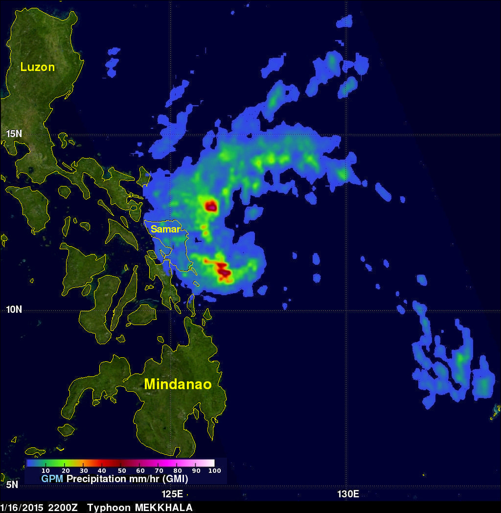
On January 16, 2015 tropical storm Mekkhala became the first western Pacific typhoon of the year just before hitting the eastern Philippines. This image shows rainfall derived from data captured by the GPM (core satellite) on January 16, 2015 at 2200 UTC. This was only about four hours after Mekkhala was upgraded to a typhoon. GPM's Microwave Imager (GMI) found rain falling at a rate of over 70.7 mm (about 2.8 inches) per hour in storms southwest of the typhoon's eye.
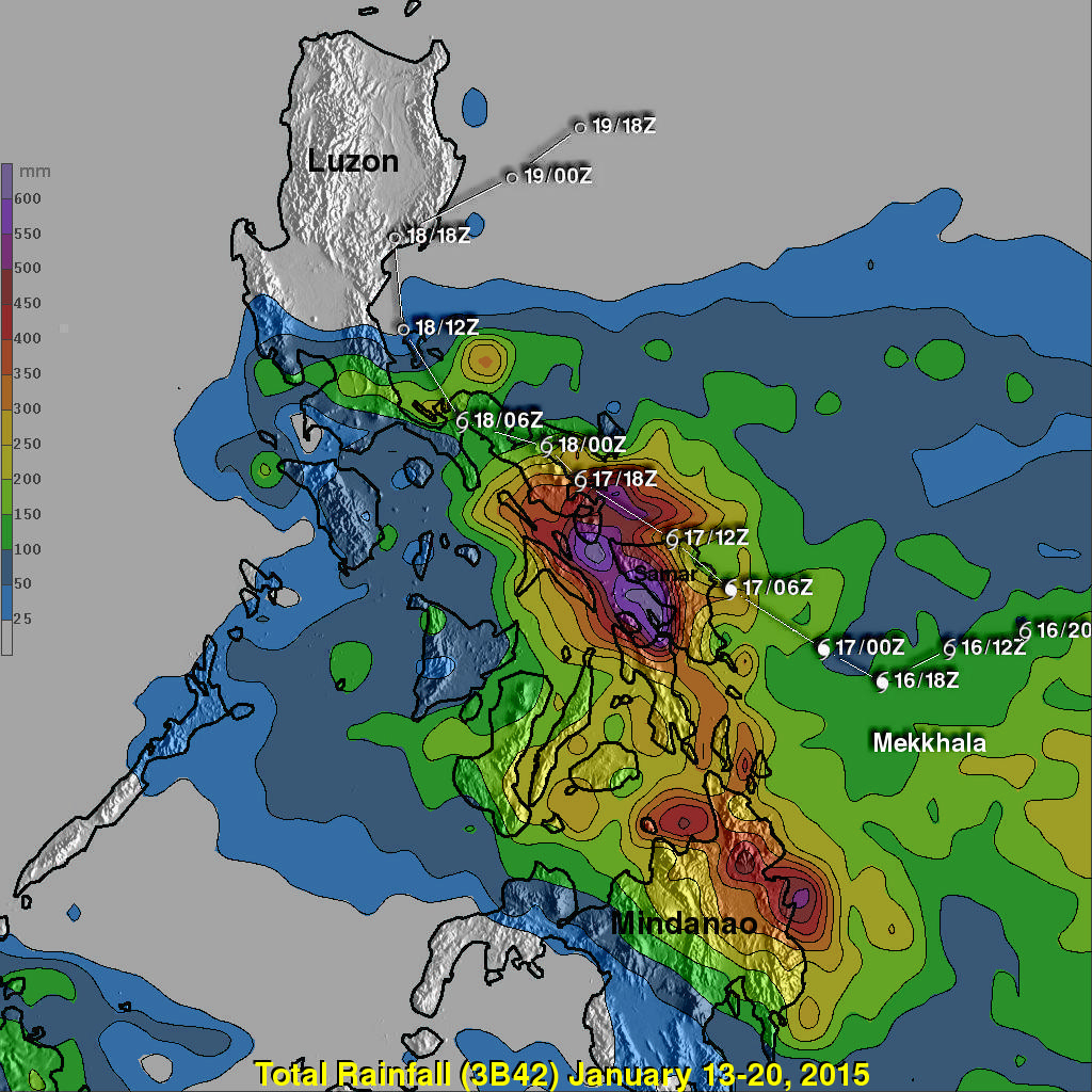
Rainfall over the Philippines, enhanced by typhoon Mekkhala, was analyzed using near real time merged satellite data (3B42). Mekkhala's track with appropriate tropical cyclone symbols is shown overlaid on the analysis. This analysis included the period from January 13-20, 2015 during which typhoon Mekkhala formed southwest of Guam and drenched the eastern Philippines. Much of the heavy rainfall from Mekkhala fell over the same area where super typhoon Haiyan devastated the Philippines in October 2013. The same area was also more recently soaked by deadly typhoon Hagiupit and tropical storm Jangmi in December 2014. This analysis found an area of maximum rainfall centered just west of Samar where extreme rainfall totals were greater than 600 mm (23.6 inches).
Mekkhala moved into the Philippine Sea east of Luzon and has now weakened to a tropical depression.