
Ian, First 2014 South Pacific Tropical Cyclone

Tropical cyclone IAN became the first tropical cyclone of the 2013-2014 South Pacific season when it formed yesterday north of Tonga. The TRMM satellite passed above IAN this morning at 1133 UTC. IAN is a small tropical cyclone but TRMM's Precipitation Radar (PR) instrument found that IAN was dropping rain at a rate of over 113 mm/hr (~4.4 inches) in some areas.
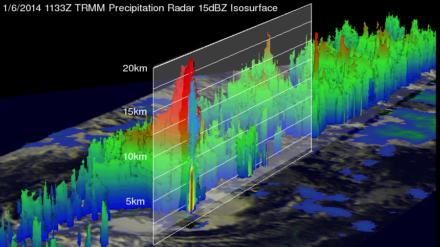
Since it was launched on November 27, 1997 TRMM's Precipitation Radar (PR) has been providing 3-D vertical profiles of rain and snow from the surface up to a height of about 12 miles (20 kilometers). A 3-D view of IAN's vertical structure, based on vertical profiles of TRMM PR radar reflectivity data, is shown here. TRMM PR found that some violent storms within IAN were reaching unusually high altitudes greater than 18.5km (~11.5 miles).
IAN is expected to become slightly more powerful with tropical storm force winds of 50kts (~58 mph) in the next couple days.