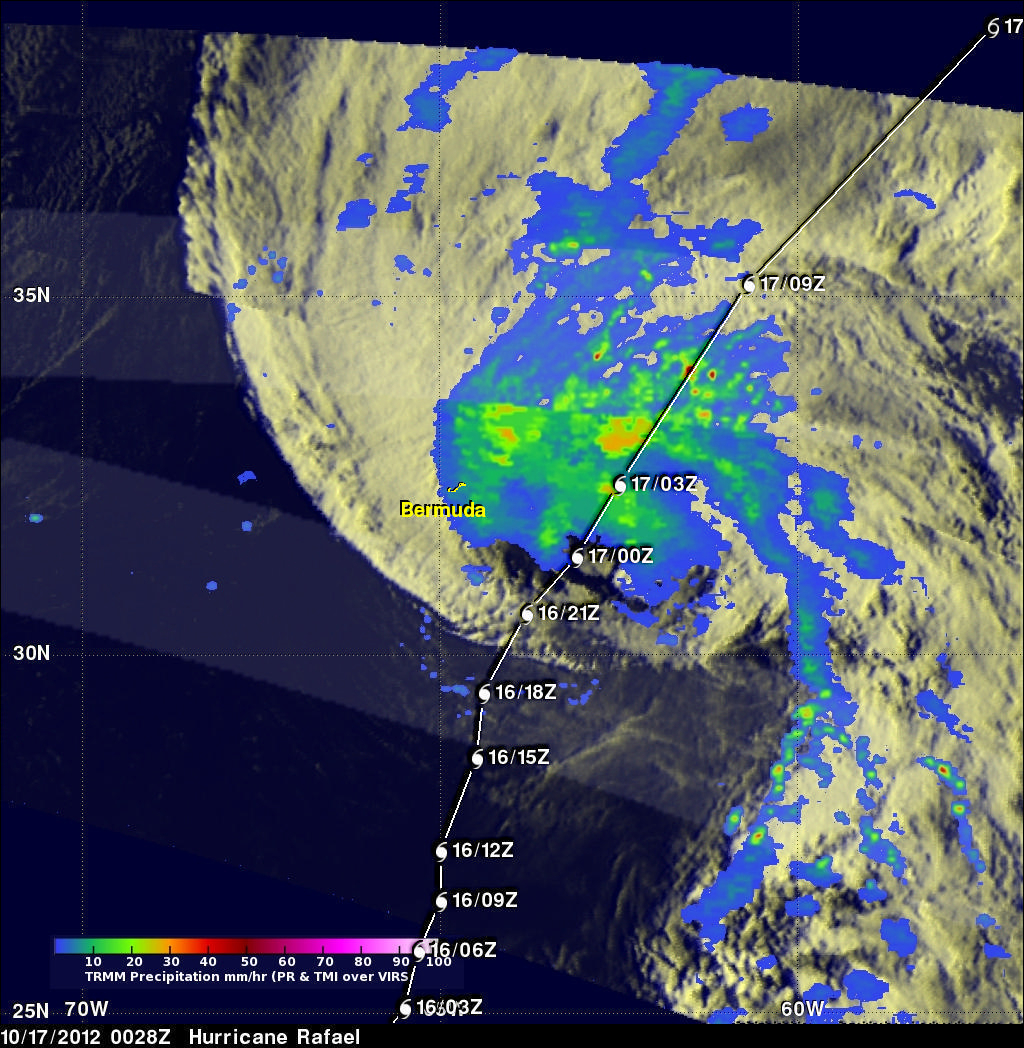
Hurricane Rafael Shown Passing Near Bermuda
Hurricane Rafael has started to pick up speed after it passed to the east of Bermuda. This image shows a TRMM rainfall analysis that used data collected from two recent passes above Hurricane Rafael. The first orbit was on Tuesday October 16, 2012 at 2250 UTC (6:50 PM EDT). The second orbit received data when TRMM passed over on Wednesday October 17, 2012 at 0028 UTC (8:28 PM EDT on October 16, 2012). TRMM's Microwave Imager (TMI) and Precipitation Radar (PR) data show that Rafael was producing rainfall over a large area of the Atlantic. Bermuda was shown getting light to moderate rain showers when it was located northwest of Rafael's center of circulation. The heaviest precipitation was shown by TRMM to be northeast of Bermuda. Some intense rain bands were dropping rain at a rate of over 60 mm/hr (~2.4 inches). Rafael's past and predicted path is shown overlaid in white.
Rafael is predicted to continue speeding toward the northeast over the open waters of the north Atlantic and become a powerful extra-tropical low later today.