Hurricane Edouard Headed for Cooler Waters
Edouard, which became the fifth named storm of the season after forming on the night of September 11th (EDT) west of the Cape Verde Islands, continued to strengthen as it made its way through the central Atlantic this past week, reaching hurricane intensity on the 14th before becoming the first major hurricane of the season when it peaked briefly as a category 3 storm on the 16th with sustained winds reported at 100 knots (~115 mph) by the National Hurricane Center (NHC). Fortunately, the storm has not posed a threat to the US East Coast due to the presence of a deep-layer trough along the Eastern Seaborde, which has prevented Edouard from moving further westward and forced it to recurve over the central Atlantic.
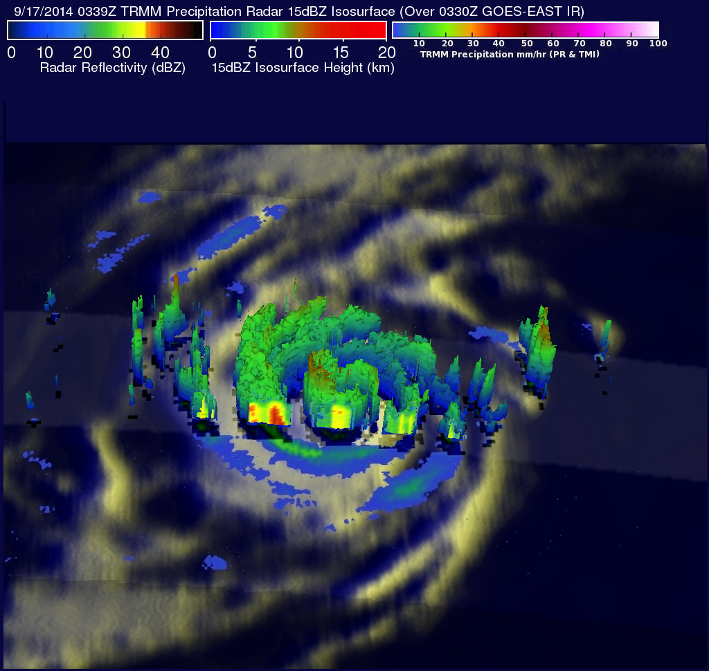
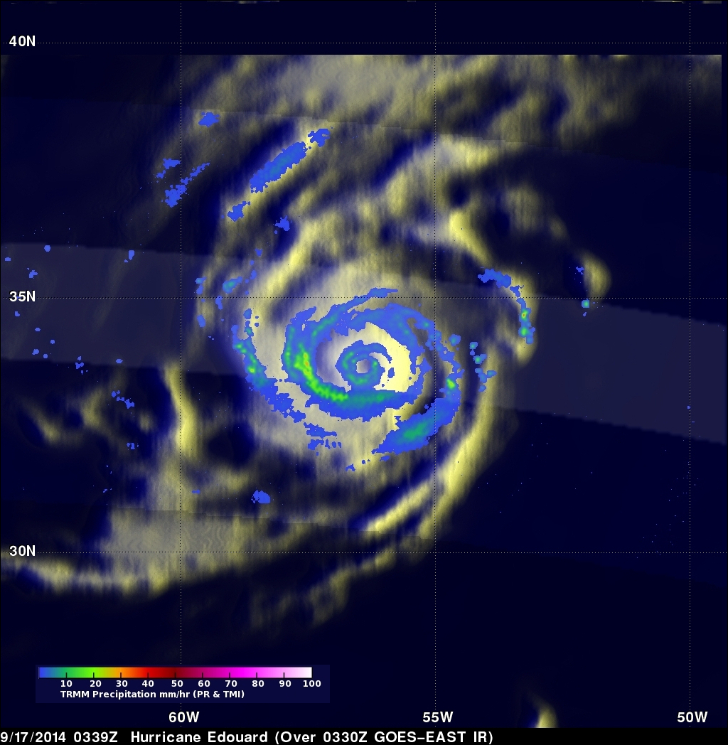
This latest overpass of Edouard by the TRMM satellite was taken last night at 03:39 UTC 17 September (11:39 pm EST 16 September) 2014 soon after the storm had begun to recurve to the northeast well east of Bermuda. By this time Edouard had weakened to a category 1 storm with maximum sustained winds reported at 80 knots (~92 mph) by NHC. However, as shown by TRMM, Edouard at this time still has a very robust and mature circulation as evidenced by the presence of a well-defined eye in the rain field and two concentric rain bands surrounding the storm's center. After tropical cyclones reach their peak intensity and continue to age, it's not uncommon for their wind field (i.e., circulation) to expand. And as is the case with Edouard, this can happen as the result of an eyewall replacement cycle wherein an newer outer eye wall forms around the original eyewall creating a double eye-wall structure (i.e., the two concentric rain bands) and another ring of stronger winds around the center but further out. At this time, Edouard's minimum central pressure was 959 mb and is nearly as deep as it was when Edouard was a category 3 storm, but the pressure gradient is now spread over a larger area, which reduces the storm's peak wind intensity but increases the areal extent of stronger winds.
A 3D image courtesy of the TRMM PR taken at the same time shows that with Edouard beginning to move over cooler waters there is little in the way of the tall convective towers that can energize the storm's circulation.
Currently Edouard is continuing to move to the northeast away from the US and is expected to begin to weaken and become post tropical before winding up somewhere west of the Azores in the next few days.