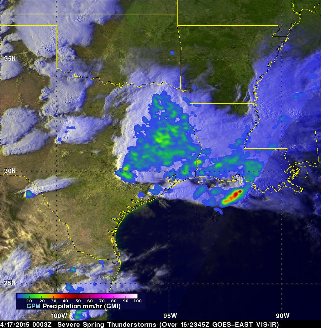
A GPM View of Tornado Spawning Thunderstorms
Twelve tornado sightings reported to NOAA yesterday were associated with severe thunderstorms extending from the Texas Gulf coast, through Oklahoma and Kansas. The GPM core observatory satellite had a good look at this area of severe weather on April 17, 2015 at 0003 UTC (April 16, 2015 at 7:03 PM CDT). A precipitation analysis using GPM's Microwave Imager (GMI) shows that some of these severe storms were dropping rain at a rate of over 86 mm (about 3.4 inches) per hour.
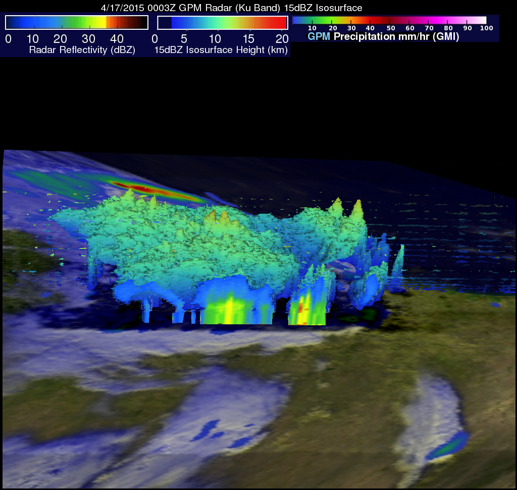
Reflectivity data from the Ku band on GPM's dual frequency radar was used to construct this 3-D view of tornado spawning thunderstorms as they moved through the southwestern United States. A color enhanced vertical slice through the western side of the storm complex shows that some reflectivity values in that area were exceeding 35 dBZ. Some intense rainfall near the center of the stormy area was returning reflectivity values of up to 58 dBZ to the satellite. Storm top heights were measured by GPM reaching altitudes of up to 13.8 km (8.6 miles).