
Giovanna Shown Becoming Dangerous
Tropical cyclone Giovanna was located in the Indian Ocean east-northeast of Madagascar when it was classified as a tropical storm on 9 Febuary 2012. The TRMM satellite image above shows Giovanna when it was rapidly becoming more powerful on 11 February 2012 at 1200 UTC. Giovanna had intensified to a category 3 tropical cyclone on the Saffir-Simpson scale with wind speeds estimated at 100 kts (~115 mph). This TRMM pass shows that an eyewall replacement was occurring at that time. A small ring of strong convective storms was located around the center of the center eye and other powerful storms are shown in the replacement eye farther out from Giovanna's center.
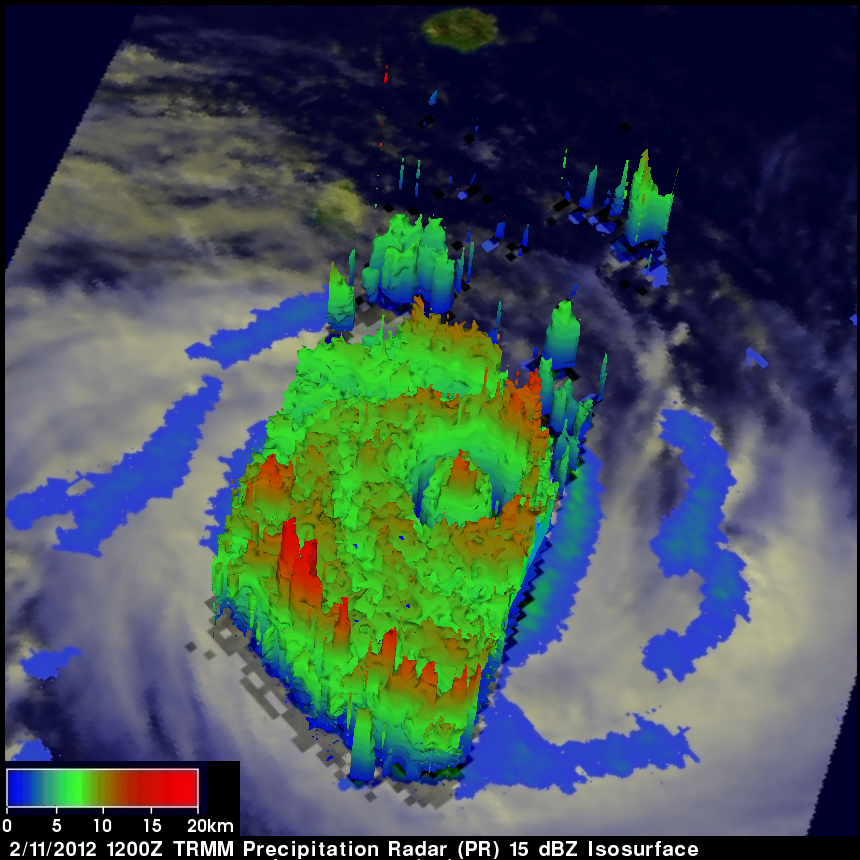
TRMM Precipitation Radar (PR) data were used in the 3-D image above. This image, looking from east, shows the structure of Giovanna's double eye wall. TRMM PR data shows that the tallest storm towers reaching to heights of almost 15km (~9.3 miles) were on Giovanna's eastern side. The storm towers in Giovanna's center were reaching to about 12km (~7.5 miles).
Click here to see an animated flyby of the 3-D PR image above.