
Eastern Pacific Tropical Cyclone Forming
The eastern Pacific Ocean has become active on cue with the start of the hurricane season in that area. Only a few days after hurricane Amanda weakened and disappeared the National Hurricane Center (NHC) says that development of another tropical cyclone is probable southeast of Salina Cruz, Mexico.
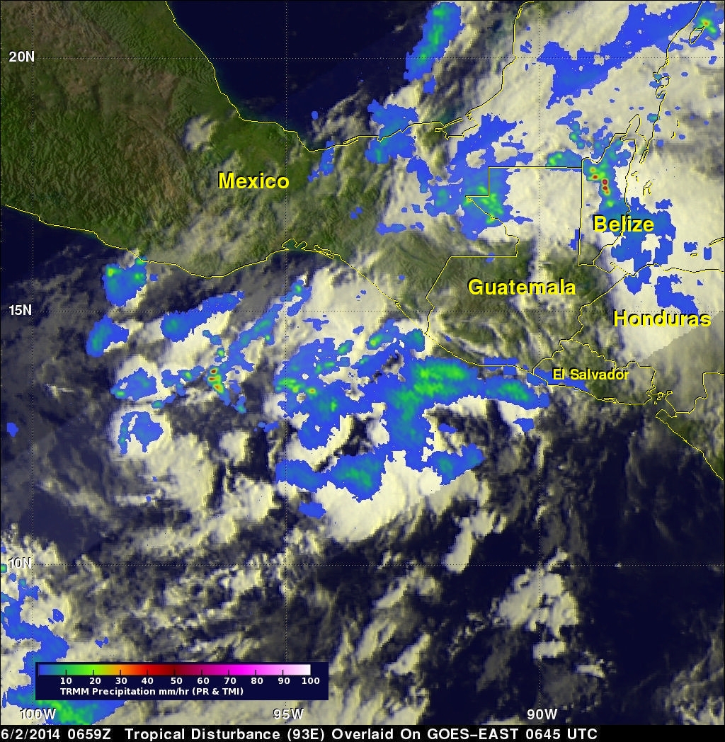
The image above shows rainfall data captured by the TRMM satellite as it flew over on June 2, 2014 at 0659 UTC. TRMM's Microwave Imager (TMI) and Precipitation Radar (PR) data are shown overlaid on an enhanced infrared image from the GOES-EAST satellite received at 0645 UTC. TRMM found areas of moderate to heavy rainfall in showers and thunderstorms within the area of this tropical low. However, the heaviest rainfall found by TRMM in the area covered by this image was 115.8 mm/hr (about 4.6 inches) in another disturbed area over Belize. The Atlantic hurricane season officially started on June 1 and that area is also being monitored by the NHC.
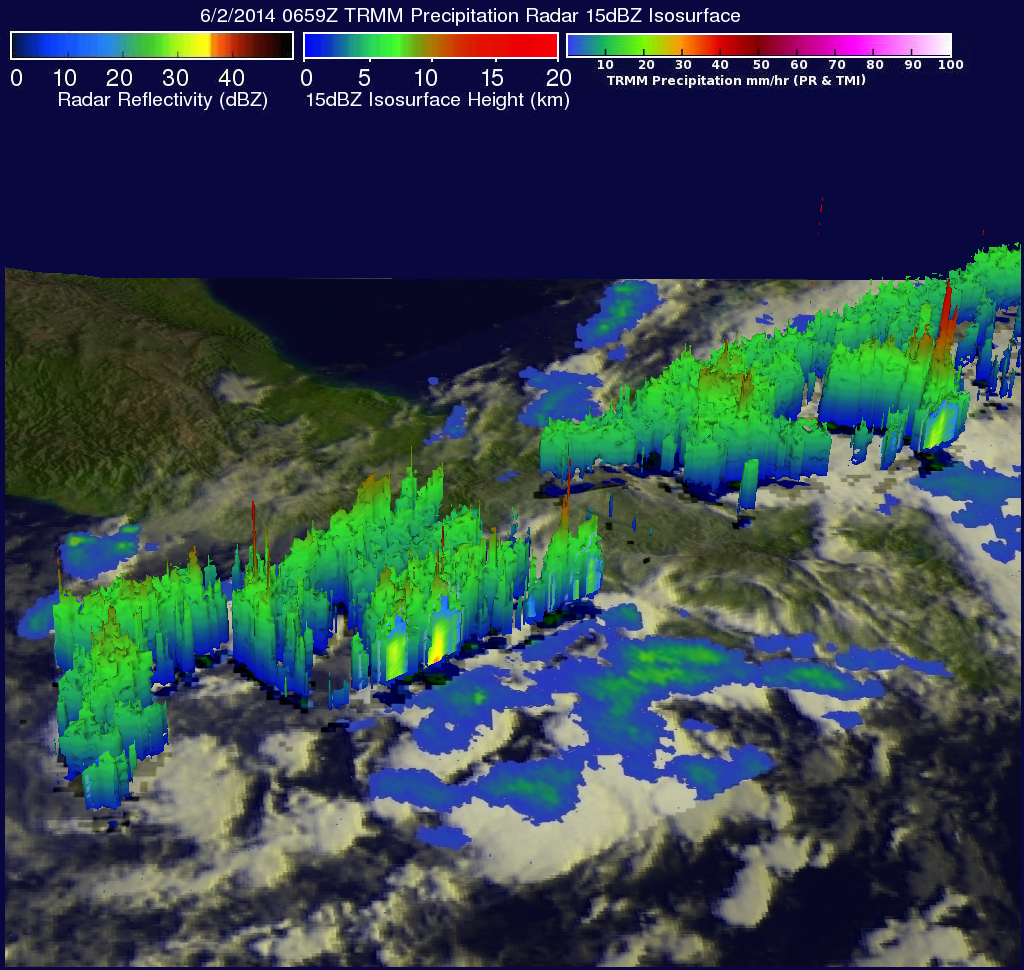
TRMM's Precipitation Radar data were used to show the 3-D structure of rainfall within the tropical low over the eastern Pacific Ocean. TRMM PR found that some tall convective thunderstorms were reaching heights of 15km (about 9.3 miles). The most extreme heights were found in the towering thunderstorms over Belize that were reaching heights of over 16.5km (about 10.2 miles) and returning dBZ values of 54.7 to the satellite.