
Dominican Republic And Haiti Hit By Deadly Floods
It has been reported that spring floods with mudslides have resulted in the death of at least 9 people and forced 11,000 people to flee their homes in the Dominican Republic.
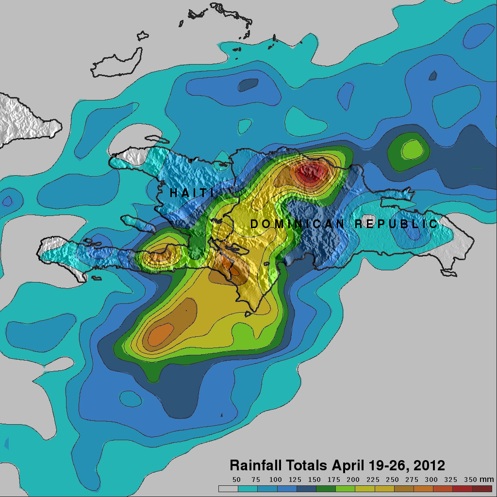
Data from the TRMM satellite are used to calibrate rainfall data merged from various satellite sources. TRMM-based, near-real time Multi-satellite Precipitation Analyses (TMPA) at the NASA Goddard Space Flight Center are used to monitor rainfall over the global Tropics. TMPA rainfall estimates are shown above for the week from April 19 to April 26, 2012. This analysis shows that extreme rainfall (shown in dark red) totaling more than 350 mm (~13.8 inches) fell over the northwestern Dominican Republic. Very heavy rainfall of over 275 mm (~10.8 inches) also fell over southeastern Haiti and the southwestern Dominican Republic.
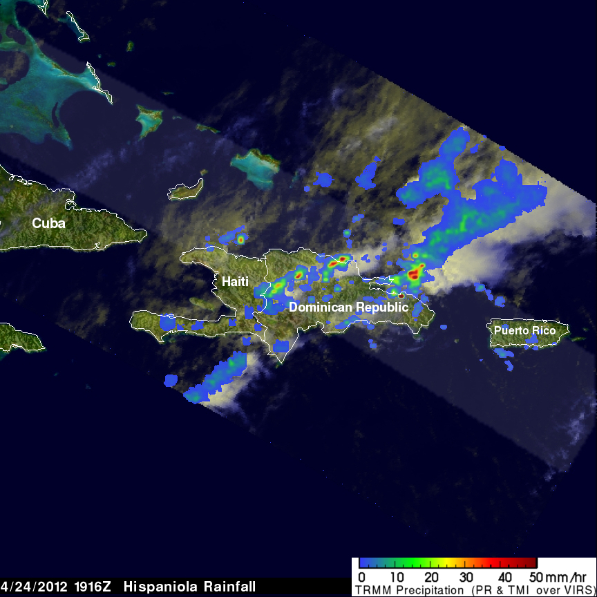
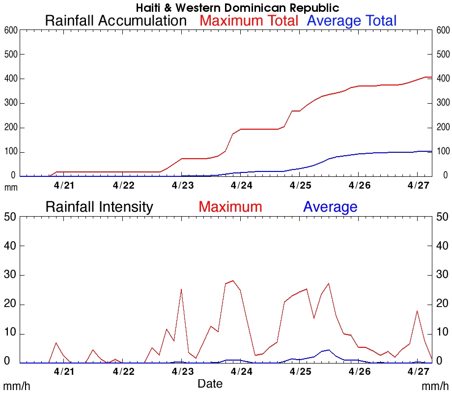
The TRMM satellite flew above this area on 24 April 2012 at 1916 UTC (3:16 PM EDT) when intense rainfall was drenching the Dominican Republic. An analysis of rainfall using TRMM Microwave Imager (TMI) and Precipitation Radar (PR) data from this orbit is shown overlaid on a visible/infrared image that used data from TRMM's Visible and InfraRed Scanner (VIRS) instrument. Below this image is a graph from near real time TMPA data showing that rainfall was occasionally dropping at a maximum rate of about 30mm/hr (~1.2 inches) on 24 and 25 April 2012.