Arabian Sea Tropical Storm Nanauk
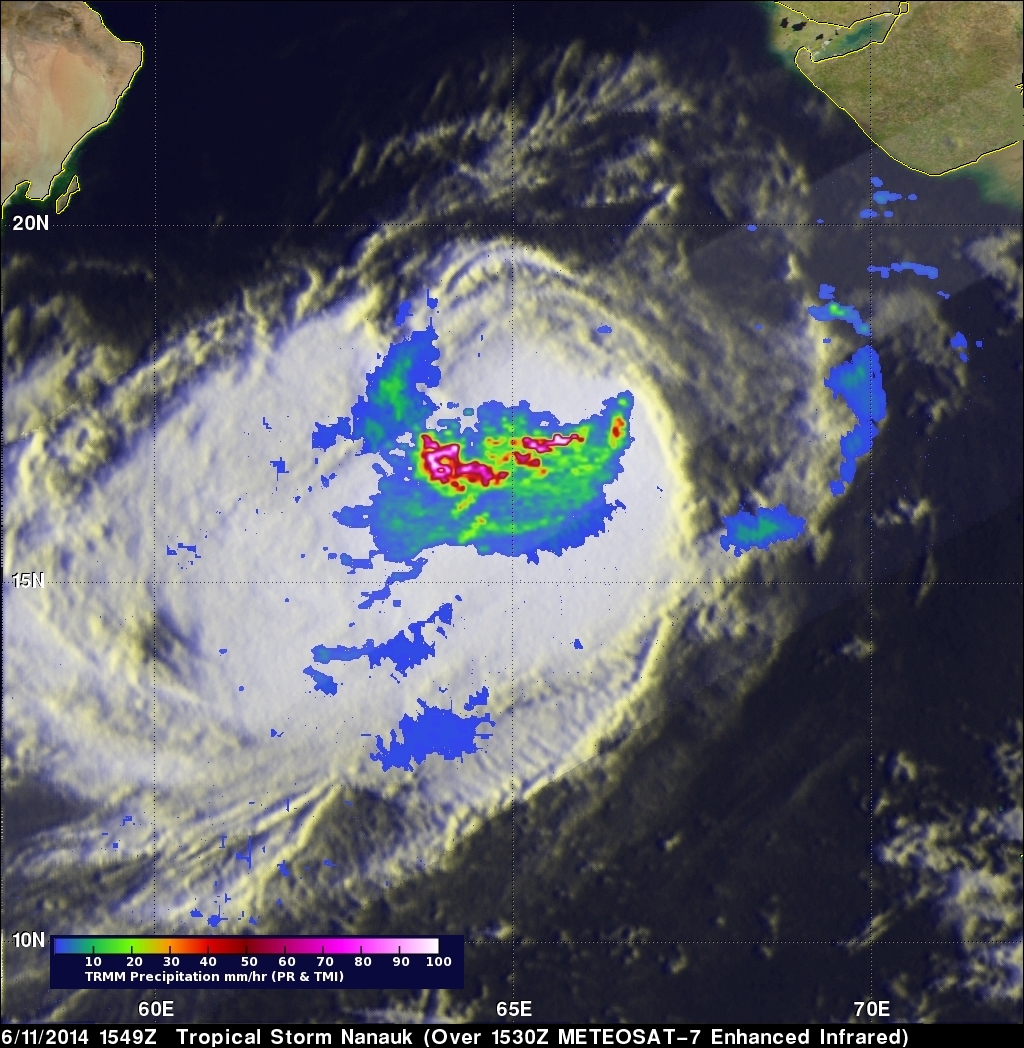
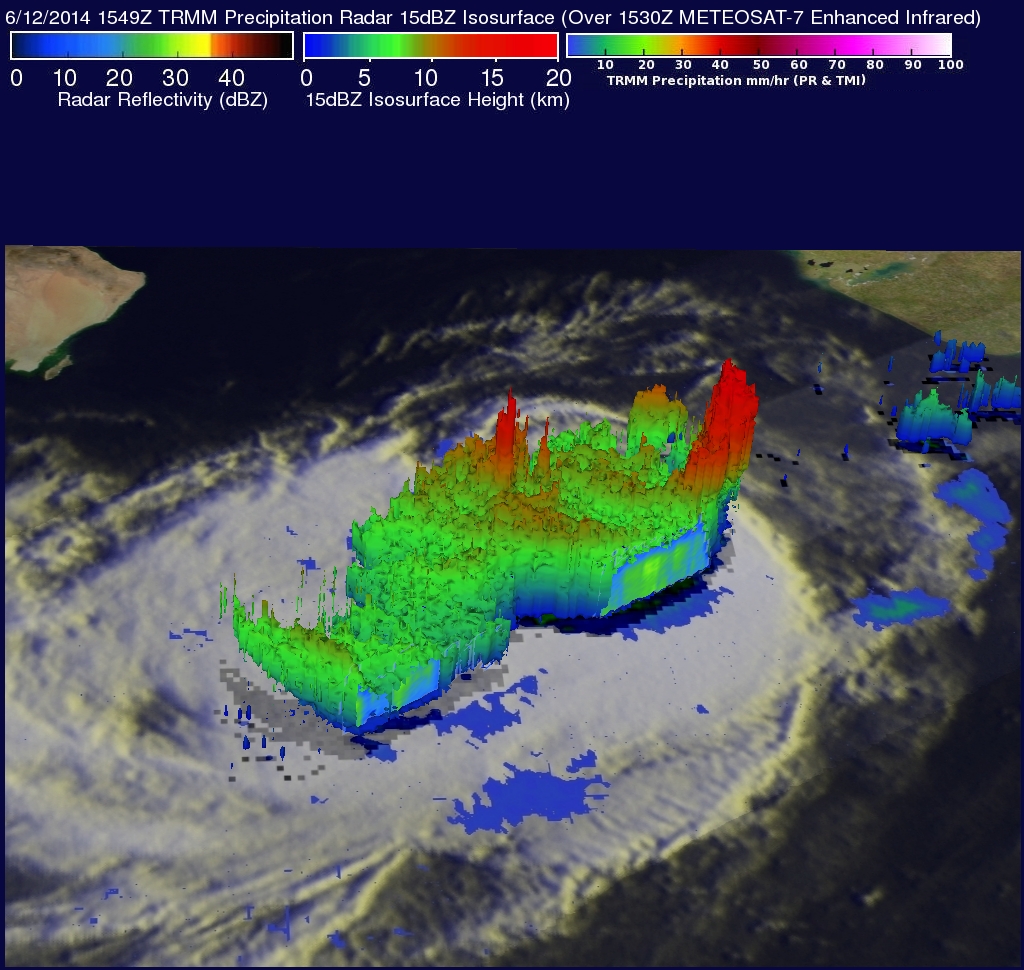
Tropical storm NANUAK formed west of India on June 10, 2014 and since then has been moving toward the northwest over the open waters of the Arabian Sea. The TRMM satellite found that NANAUK contained powerful storms dropping rain at a rate of over 247.3 mm/hr (about 9.7 inches) when viewed on June 11, 2014 at 1549 UTC. An analysis of rainfall from TRMM's Microwave Imager (TMI) and Precipitation Radar (PR) is shown above overlaid on a 1530 UTC enhanced infrared image from the METEOSAT-7 satellite. TRMM PR data were used in the 3-D view shown in the second image. Those data showed that NANAUK contained powerful convective thunderstorm towers that were reaching heights of up to 16.8 km (about 10.4 miles). Some of the intense downpours in NANAUK were returning radar reflectivity values greater than 59 dBZ to the satellite.
Tropical Storm NANAUK had sustained wind speeds estimated at 55kts (about 63 mph) with this TRMM pass. The tropical storm is predicted by the Joint Typhoon Warning Center (JTWC) to slowly weaken over the next couple days while heading toward the Gulf Of Oman.
Click here to see a Low Resolution 640X360 Quicktime TRMM PR flyby animation.
Click here to see a Low Resolution 640X360 MPEG TRMM PR flyby animation.