
Another Tropical Cyclone Developing

While Tropical storm Aletta is forecast to weaken and dissipate another tropical cyclone appears to be forming in the eastern Pacific south of Acapulco, Mexico. The TRMM satellite passed above this tropical disturbance (92E) on 18 May 2012 at 0957 UTC. Data captured with this pass by TRMM's Microwave Imager (TMI) and Precipitation Radar (PR) instruments were used in the rainfall analysis shown. This analysis indicates that this area contained very heavy rainfall in the northeastern quadrant of the disturbance. Some storms were producing rainfall at a rate of over 50 mm/hr (~2 inches).
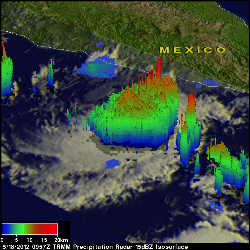
A 3-D image from TRMM PR shows that a few of these strong convective storms reached heights of about 15km (~9.3 miles). Radar reflectivity values of over 50 dBz found by TRMM PR in this stormy area provided more evidence that heavy rainfall was occurring. The National Hurricane Center (NHC) assigned this disturbed area a 40% probability of becoming a tropical cyclone within the 48 hours. It would be named Bud.