Adrian now a Powerful Hurricane
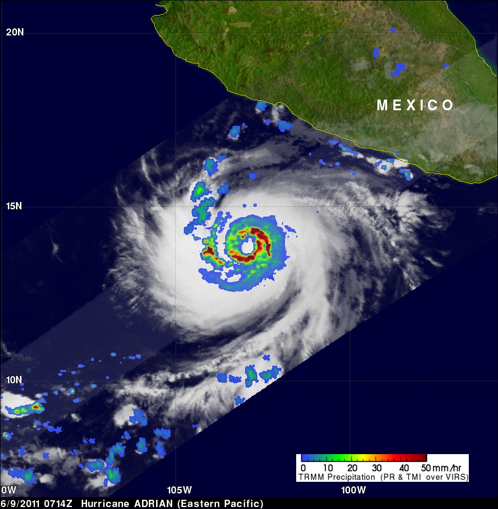
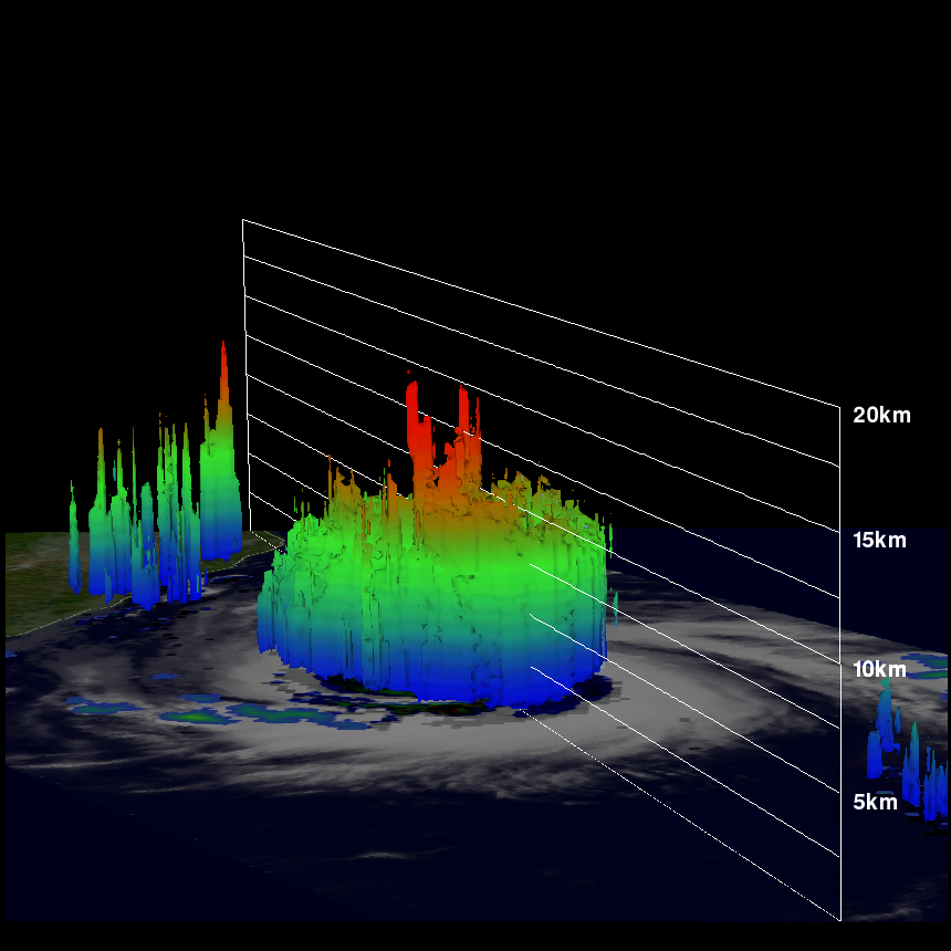
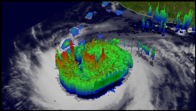
The TRMM satellite captured data used in this dramatic image of Hurricane Adrian when it passed directly above on 9 June 2011 at 0714 UTC. The increasingly powerful hurricane had sustained winds estimated to be close to 80 kts (~92 mph) at the time of this pass. TRMM's Precipitation Radar (PR) instrument revealed that beneath the clouds there were intense thunderstorms dropping rain at a rate of over 50 mm/hr (~2 inches) in a nearly circular eye wall. The PR also indicated that some thunderstorms in the eye wall were shooting up to heights above 15 km (~9.3 miles). Click here to see a simulated flyby around Adrian courtesy of TRMM's Precipitation Radar data from this orbit.