
Weakening Tropical Storm Eugene Investigated With GPM Satellite
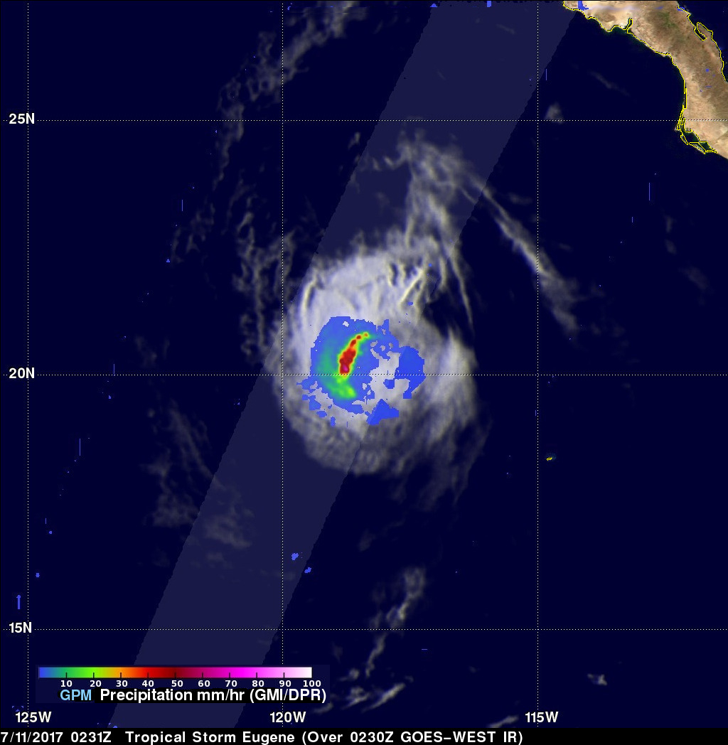
The GPM core observatory satellite had another excellent view of Eastern Pacific tropical storm Eugene on July 11, 2017 at 0231 UTC. Eugene was weakening as it traveled toward the northwest over progressively cooler waters. The only remaining strong convective activity was seen in Eugene's northwestern quadrant. GPM's Dual-Frequency Precipitation Radar (DPR) data revealed that some of these convective storms northwest of Eugene's center of circulation were dropping rain at a rate of more than 70 mm (2.8 inches) per hour.
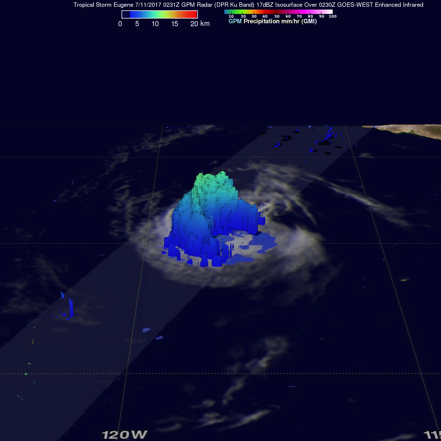
A 3-D view of the dissipating tropical storm was developed using GPM's radar (DPR Ku Band). This 3-D cross section through the center of tropical storm Eugene showed that the tallest storm tops northwest of Eugene's center were reaching heights of about 11 km ( 6.8 miles).
Eugene is predicted to continue weakening and only have maximum sustained wind speeds of about 30 kts (~ 35 mph) tomorrow.
