Typhoon Megi Hits Taiwan

Three typhoons have battered Taiwan in the past few weeks. Super Typhoon MERANTI, the strongest typhoon of the year, caused havoc as it passed to the south of Taiwan on September 14, 2016. Typhoon Malakas clipped northeastern Taiwan a few days later. Typhoon Megi has now caused injuries, deaths and destruction as it passes over northeastern Taiwan.
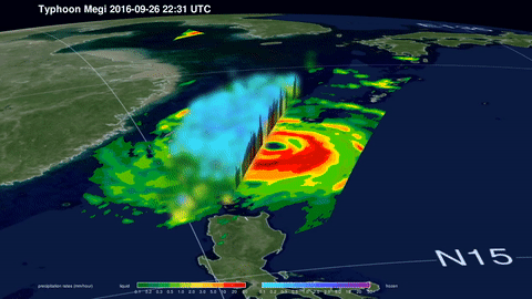
The GPM core observatory satellite passed over on September 26, 2016 at 2231 UTC when typhoon Megi was approaching Taiwan from the Philippine Sea. Megi was intensifying with maximum sustained wind speeds estimated at 100kts (115 mph). The typhoon's wind speeds peaked before it hit Taiwan with winds of 115 kts (132 mph). Data from GPM's Microwave Imager (GMI) and Dual-Frequency Precipitation Radar (DPR) instruments show the location of intense rainfall within the typhoon. GPM's DPR data indicated that rain was falling at a rate of over 250 mm (9.8 inches) per hour in the western side of Megi's eye wall. This extreme rainfall is likely to cause flash floods and landslides in Taiwan's mountainous terrain.
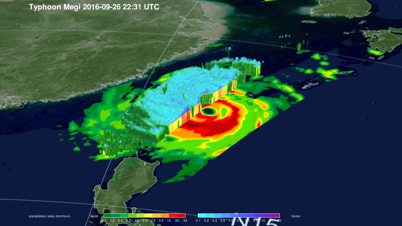
DPR data were used to show the 3-D shape of precipitation within Typhoon Megi. Some tall storm tops spiraling around the typhoon were found to reach heights above 15 km (9.3 miles).
Typhoon Megi's wind speeds have dropped as it interacted with Taiwan's rough terrain. The Joint Typhoon Warning Center (JTWC) predicts that Megi will still have wind speeds of 80 kts (92 mph) when it hits the Chinese coast on September 27, 2016 at about 1800 UTC.