Typhoon Haima Hits China After Devastating The Northern Philippines
After Haima's caused extensive destruction and at least 13 deaths in the northern Philippines the typhoon traveled across the South China Sea to batter Hong Kong and mainland China. Heavy rain and gusty winds accompanied Haima as the typhoon passed to the east of Hong Kong. Operations at Hong Kong's international airport were nearly stopped by the typhoon. At least one person was reported killed in Hong Kong. Haima made landfall in China 110 km (68 miles) east of Hong Kong at about 0400 UTC (noon CST). Haima's winds were decreasing and the typhoon was the equivalent of a category one hurricane on the Saffir-Simpson hurricane wind scale when it came ashore.
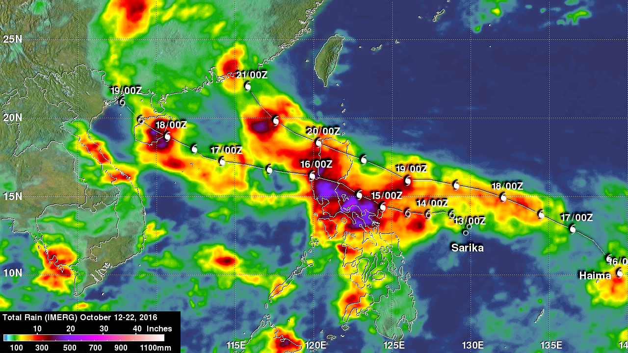
NASA's Integrated Multi-satellitE Retrievals for GPM (IMERG) were again used to show total rainfall estimates. This analysis shows IMERG rainfall total estimates during the period from October 12 to 22, 2016 when typhoons Sarika and Haima were active. Total estimates from IMERG were updated to include rainfall that fell in the Philippines as Haima moved over the South China Sea toward China. The northern Philippine island of Luzon received by far the highest rainfall rainfall totals over land during this period. The return flow by typhoon Haima from the South China sea onto western Luzon added to the extreme rainfall that the earlier typhoon Sarika supplied to the Philippines. Rainfall from typhoon Haima increased the IMERG total precipitation estimates to over 500 mm (19.7 inches) over western Luzon. The mainland China coast also was estimated by IMERG to have received over 200 mm (7.9 inches) of rain as typhoon Haima dissipated over land.