Two Cyclones Hit Somalia and Oman Within a Week
The first cyclone to strike the area, Sagar, formed from an area of thunderstorm activity located in the western Arabian Sea south of the island of Socatra. The area of low pressure associated with the thunderstorms first moved northwest into the far eastern Gulf of Aden, where it intensified into a minimal tropical storm with sustained winds estimated at 35 knots (~40 mph) by the Joint Typhoon Warning Center (JTWC), before turning west and then southwest down the middle of the Gulf. As it moved down the Gulf, Sagar slowly strengthened into a stronger tropical storm with sustained winds eventually reaching 55 knots (~63 mph) as it neared the far northwest coast of Somalia where it then made lanfall on the 19th of May. The storm brought strong winds, heavy rains and flooding to the area, battering coastal villages, swamping farmland and displacing thousands. The storm has been blamed for 52 deaths in Somalia, 2 in nearby Djibouti, and 1 in Yemen. Soon after Sagar made landfall, the next storm to hit the area, Mekunu, a more powerful storm, was already forming. Like Sagar, Mekunu also formed from an area of convection, but farther out into the Arabian Sea. Mekunu became a tropical storm on the 22nd of May about 585 miles (~940 km) south-southeast of the coast of Oman. Over the next few days, the center of the storm moved steadily to the north-northwest straight for the southwest coast of Oman. As it did so, Oman continued to steadily strengthen, first into a category 1 cyclone on the 23rd and 24th as it passed just east of the island of Socatra, then into a category 2 cyclone as it approached the coast of Oman on the 25th, and finally into a category 3 cyclone with 1-minute sustained winds estimated at 100 knots (115 mph) by JTWC late on the 25th just before making landfall near Salalah, Oman's second largest city, where according to reports the storm dumped nearly 11 inches of rain (~280 mm) in 24 hours, which is more than 3 times their annual average rainfall of 82 mm (3.2 inches). Mekunu is being blamed for 6 fatalities in Oman and 24 in Yemen, 4 on the mainland and 20 on the island of Socatra.

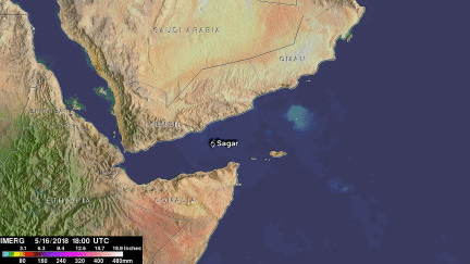
The Integrated Multi-satellitE Retrievals for GPM or IMERG is used to make estimates of precipitation from a combination of passive microwave sensors, including the GMI microwave sensor onboard the GPM satellite, and geostationary IR (infrared) data. IMERG is very helpful for estimating rainfall over the vast areas of the globe that lack good radar coverage. The following image shows IMERG rainfall estimates for the period 16 to 28 May 2018 for the Southern Arabian Peninsula, Horn of Afria, and the western Arabian Sea in association with the passage of Tropical Storm Sagar and Cyclone Mekunu. IMERG estimates show that the heaviest rains associated with the passage of Tropical Storm Sagar fell offshore over the central Gulf of Aden; however, the storm still brought on the order of 40 to as much as 160 mm (~1.5 to 6 inches) of rain to the southeast coast of Yemen and eastern Djibouti and as much as 180 mm (~7 inches) to parts of western Somalia. As with Sagar, most of the heaviest rain from Mekunu appears to have fallen over water with the exception of the island of Socatra where IMERG estimates suggest that 400 to 500 mm (~16 to 20 inches) of rain (shown in the whiteish areas) may have fallen. As for coastal Oman and Yemen, Mekunu is estimated to have brought from 100 to over 320 mm (~4 to 12 inches) of rain to the southeast coast of Yemen and the southwest coast of Oman where it made landfall. And, farther inland, the storm may have brought 50 to 160 mm (~2 to 6 inches) to parts of the Eastern Province in southeast Saudi Arabia.