Tornado Spawning Storms Examined By GPM Satellite
On Wednesday May 24, 2017 severe weather affected a large area of the eastern United States. Tornadoes were reported in Florida, Georgia, South Carolina, North Carolina and Ohio.
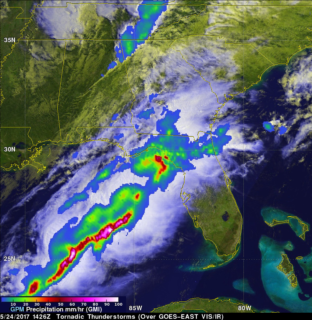
The GPM core observatory satellite flew above a line of tornado spawning storms that were moving through the Florida panhandle on May 24, 2017 at 10:26 AM EDT ( 1426 UTC). GPM's Microwave Imager (GMI) and Dual-Frequency Precipitation Radar (DPR) instruments collected data showing that very heavy downpours were accompanying some of these storms. The violent storms moving through the Southeast were strong but GPM's Radar (Ku Band) indicated that the most intense rain showers were located over the Gulf Of Mexico west of Florida. GPM's radar indicated that some of these powerful storms were dropping rain at a rate of over 8.5 inches (215 mm) per hour.
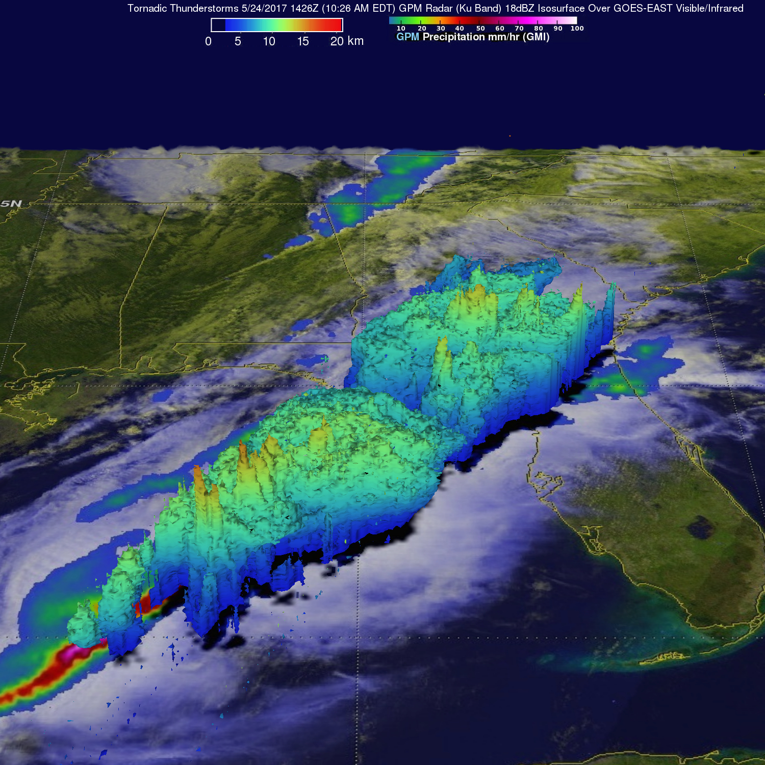
This image shows a 3-D cross section of raw radar reflectivity data that were collected by the GPM satellite's radar (DPR Ku Band). GPM found that the tops of powerful storms moving over northern Florida were reaching heights above 8.7 miles (14 km). Storm tops above the extreme storms in the Gulf Of Mexico were shown by GPM to reach altitudes above 9.2 mile (16 km).