Subtropical Depression Five Observed By GPM
Subtropical Depression FIVE formed in the central Atlantic Ocean early today. The National Hurricane Center (NHC) classified it as subtropical. It is moving over warm ocean waters and has low vertical wind shear aloft so the system is predicted to slightly intensify.
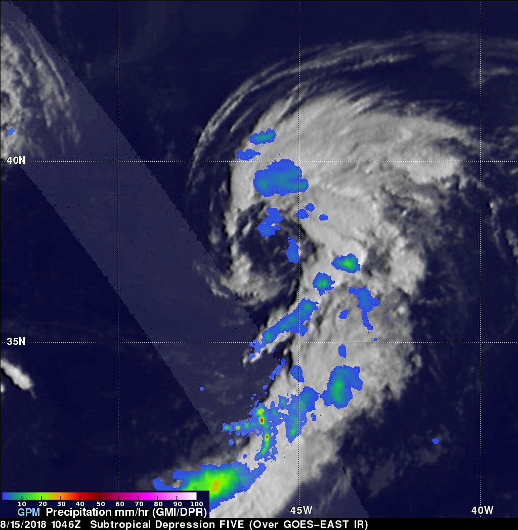
The GPM core observatory satellite passed above the western side of newly formed Subtropical Depression FIVE on August 15, 2018 at 1046 UTC. The GPM's Microwave Imager (GMI) and Dual-Frequency Precipitation Radar (DPR) instruments revealed that most of the rainfall within the subtropical depression was outside the middle of the low level center of circulation. The heaviest rainfall was measured by GPM's DPR in a large feeder band that was spiraling into the southern side of the system. Powerful convective thunderstorms in that area were measured dropping rain at a rate of over 101 mm (~ 4 inches) per hour.
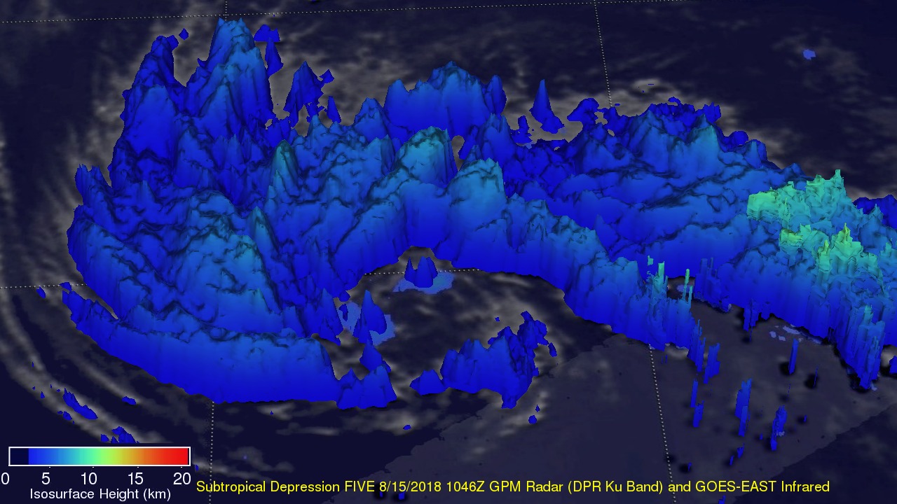
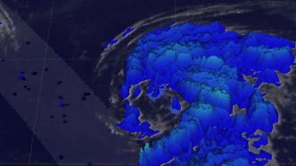
GPM's radar data (DPR Ku Band) were used in this 3-D view from the East of the subtropical depression FIVE. DPR's scans were used to show the precipitation structure of storm tops within subtropical depression FIVE. DPR found that storm tops were reaching heights above 11 km (6.8 miles) in convective storms located southeast of the system's center of circulation. Storm top height estimates over a larger area than the GPM's radar swath (shown in lighter shades) were made possible by blending measurements from DPR with cloud top heights based on the GOES-EAST satellite's infrared temperatures.