Powerful Tropical Cyclone Ula Monitored By GPM
Tropical cyclone ULA's winds peaked at 115 kts (132 mph) over the weekend. These high winds meant that for a couple days ULA was a category four tropical cyclone on the Saffir-Simpson Hurricane Wind Scale. ULA moved over the waters of the North Fiji Basin between the Fiji Islands and New Caledonia before moving southeastward into the South Fiji Basin.
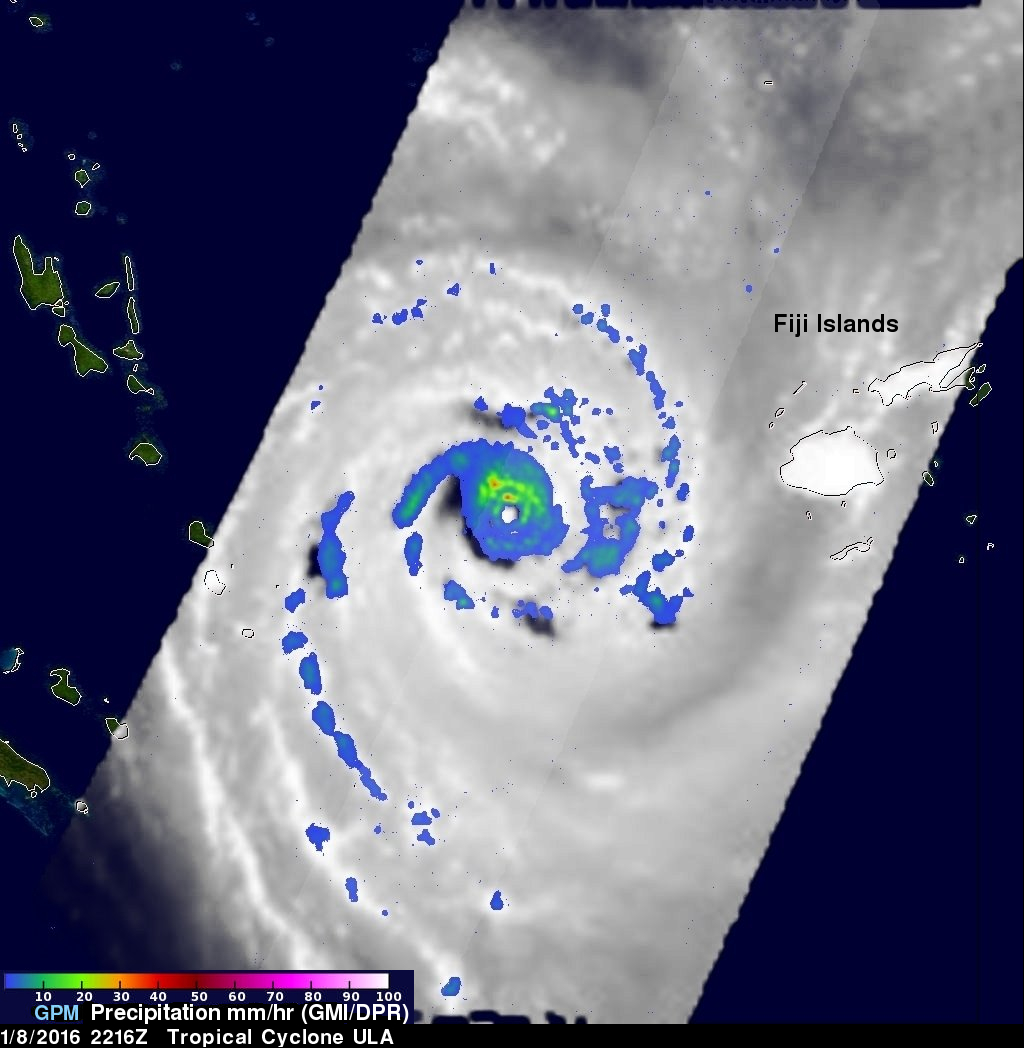
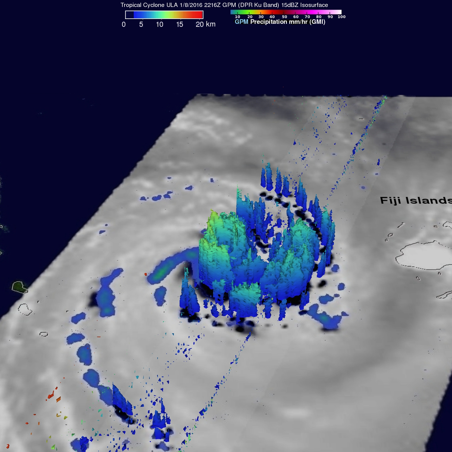
The GPM core observatory satellite had good looks at powerful tropical cyclone ULA during it's changes in intensity. On January 8, 2015 at 2216 UTC GPM saw that rain was falling at a rate of over 63.5 mm (2.5 inches) north of the intensifying tropical cyclone's eye. GPM's Dual-Frequency Precipitation Radar (DPR) instrument (Ku Band) collected 3-D data showing that storm tops were reaching heights above 12.2 km (7.6 miles) in ULA's inner and outer eye walls.
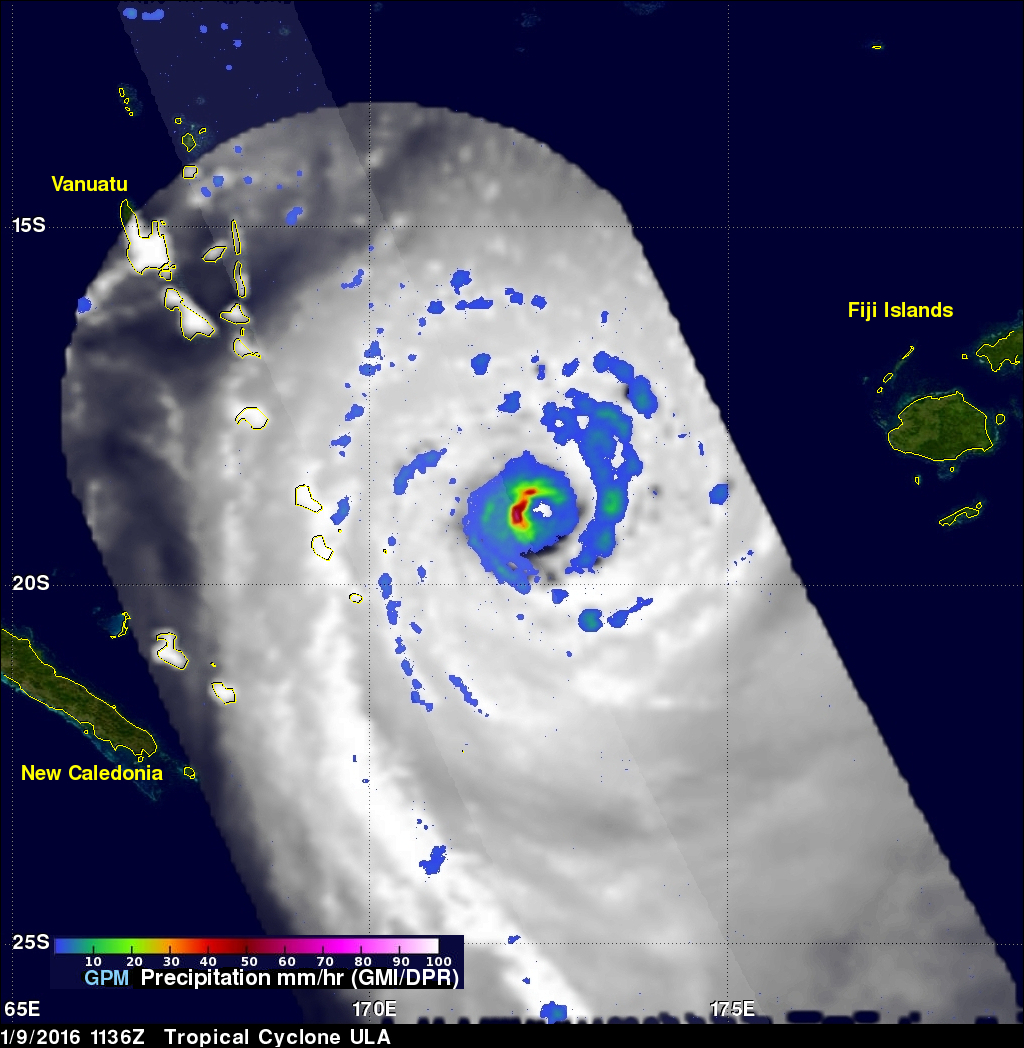
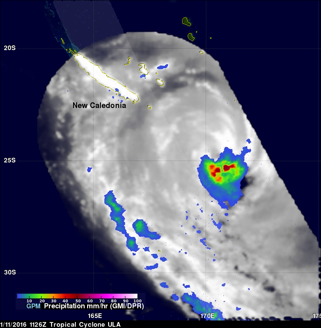
GPM also had fairly good looks at tropical cyclone ULA on January 9, 2016 at 1136 UTC and on January 11, 2016 at 1126 UTC. GPM's Microwave Imager (GMI) revealed that heavy rain was falling around ULA's eye on both dates.
Tropical cyclone ULA started to weaken as it moved toward the southeast away from New Caledonia. The Joint Typhoon Warning Center (JTWC) predicts that ULA will be a weakening tropical storm tomorrow as it passes over the open waters of the South Pacific Ocean well to the north of New Zealand.