
Intensifying Tropical Storm Jose
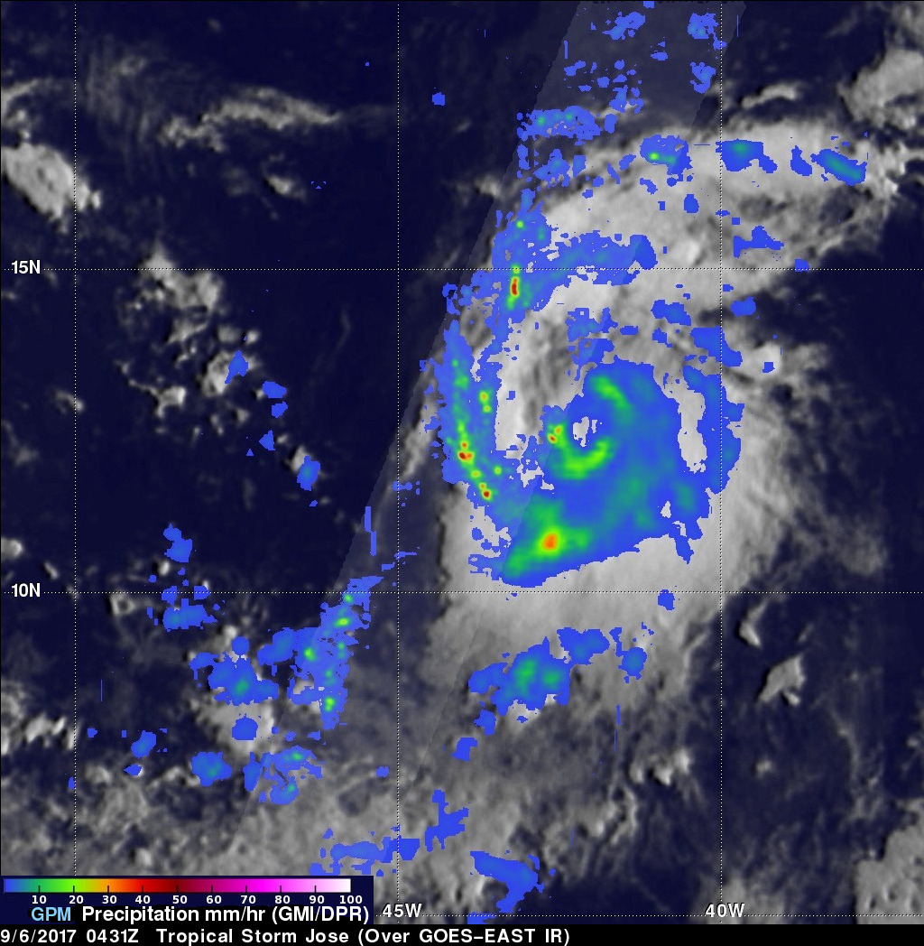
On September 5, 2017 tropical Storm Jose became the tenth named storm of the Atlantic hurricane season. The GPM core observatory satellite passed above the intensifying tropical cyclone on September 6, 2017 at 00:45 AM AST (0435 UTC). Data collected by GPM's Microwave Imager (GMI) at that time showed that weak bands of rain were starting to develop around Jose's center of circulation. GPM's Dual-Frequency Precipitation Radar (DPR) data swath revealed the location of heavy rain in a feeder band on Jose's western side. DPR found that rain in this area was falling at a rate of over 5.3 inches (134 mm) per hour.
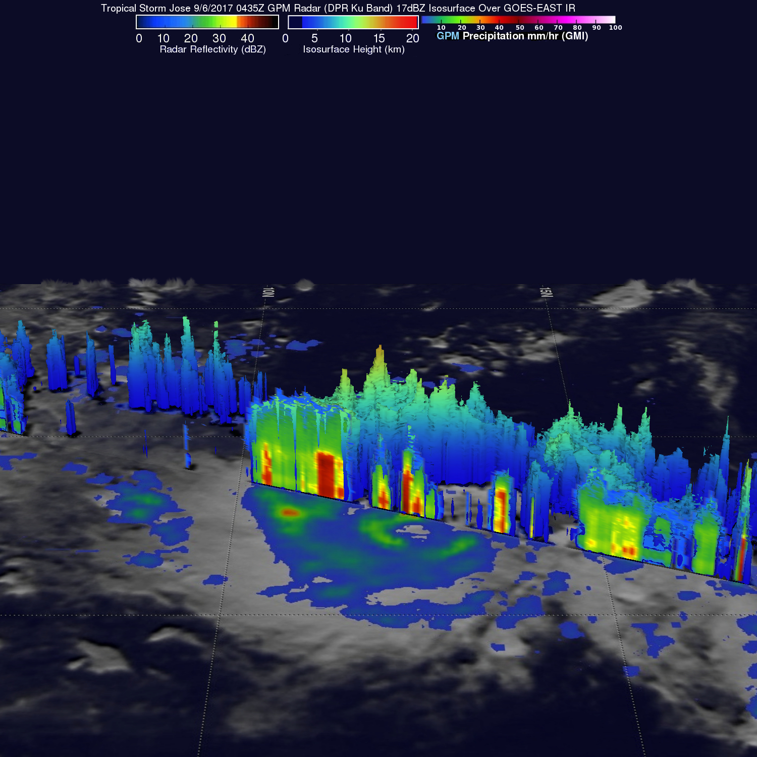
GPM's radar data (DPR Ku band) were used to develop a 3-D cross section that showed the structure of precipitation in the most powerful storms on the western side of the storm. This examination showed that a few storm tops in this feeder band were reaching to heights of almost 9.9 miles (16 km).
The National Hurricane Center (NHC) predicts that Jose will intensify and be a hurricane by early September 7, 2017. Hurricane Jose is then expected to pass to the northeast of the Leeward Islands.