Intensifying Tropical Storm Jelawat Evaluated By GPM
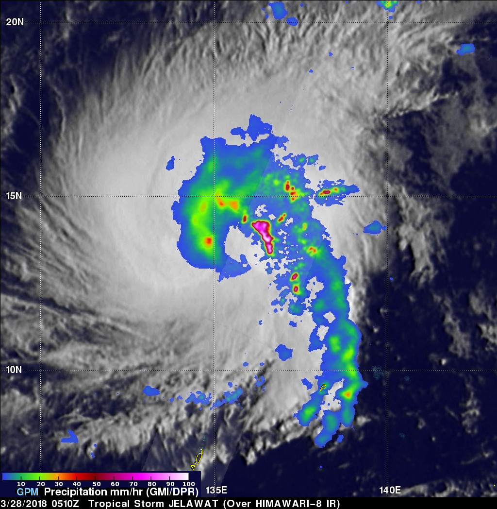
The GPM core observatory satellite flew almost directly above large intensifying tropical storm JELAWAT on March 28, 2018 at 0510 UTC. Rainfall measurements shown here were derived from data collected by GPM's Microwave Imager (GMI) and Dual Frequency Precipitation Radar (DPR) instruments. These satellite instruments provided excellent coverage of JELAWAT's precipitation. GPM's Radar (DPR Ku Band) swath included exceptionally powerful storms within a large intense feeder band that was wrapping around the eastern side of the tropical storm. GPM's DPR revealed that these strong convective storms were dropping rain at a rate of more than 264 mm (10.4 inches) per hour.
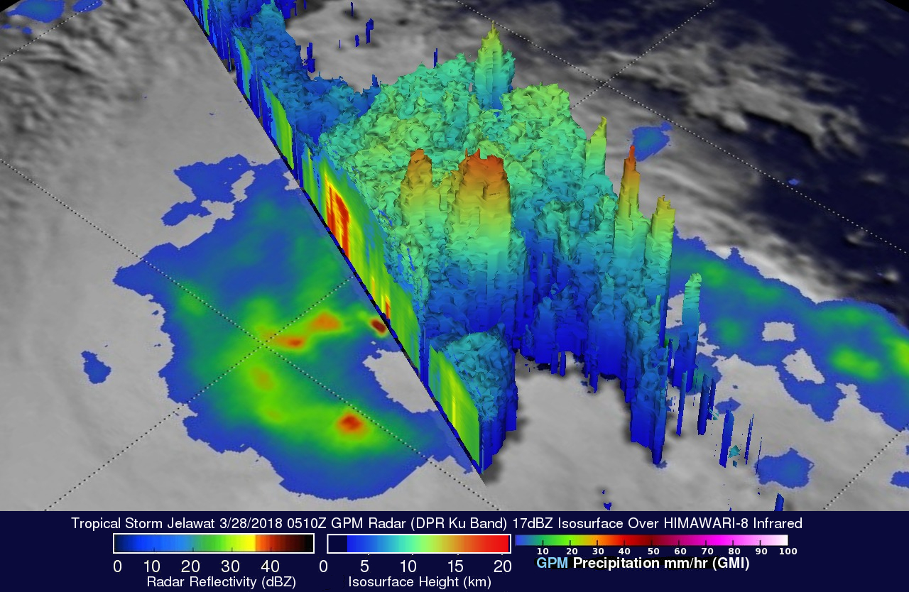
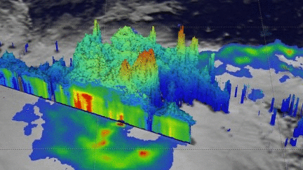
The GPM core observatory satellite's radar (DPR Ku Band) provided data that were used in this 3-D view of tropical storm JELAWAT's precipitation. GPM's radar probed convective storms in the large feeder band wrapping around the tropical storm's eastern side. The heights of precipitation were color enhanced. Lower heights are blue and taller storms are red. GPM found that some of these powerful storms were reaching heights of almost 18 km (11.2 miles).
The Joint Typhoon Warning Center (JTWC) predicts that tropical storm JELAWAT will rapidly intensify. JELAWAT is predicted to become the first western Pacific Ocean typhoon of 2018. Favorable environmental conditions such as low vertical wind shear and warm sea surface temperatures are expected to aid in JELAWAT's rapid intensification.