
Intensifying Tropical Depression Nine Checked By GPM
The National Hurricane Center (NHC) expects Tropical Depression Nine to intensify over the next day or so. Vertical wind shear is predicted to be low and the tropical depression is moving over warmer water. Both of these factors will provide fuel for intensification.
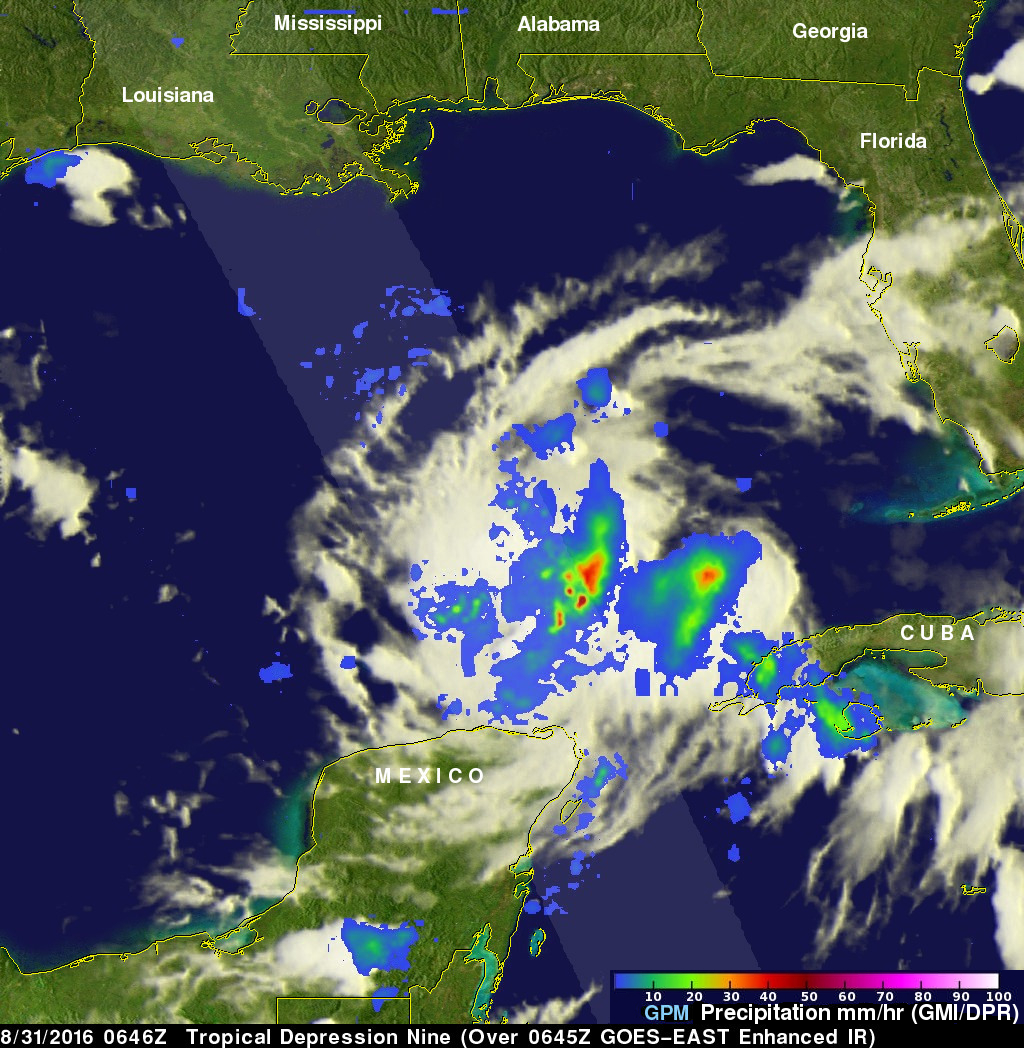
The GPM core observatory satellite scanned the tropical depression on August 31, 2016 at 2:46 AM EDT (0646 UTC). GPM's Microwave Imager (GMI) and Dual-Frequency Precipitation Radar (DPR) instruments saw heavy rainfall in strong convective storms in the Gulf Of Mexico northwest of Cuba. GPM's DPR found that some of these intense storms were dropping rain at a rate of greater than 4.1 inches (105 mm) per hour.
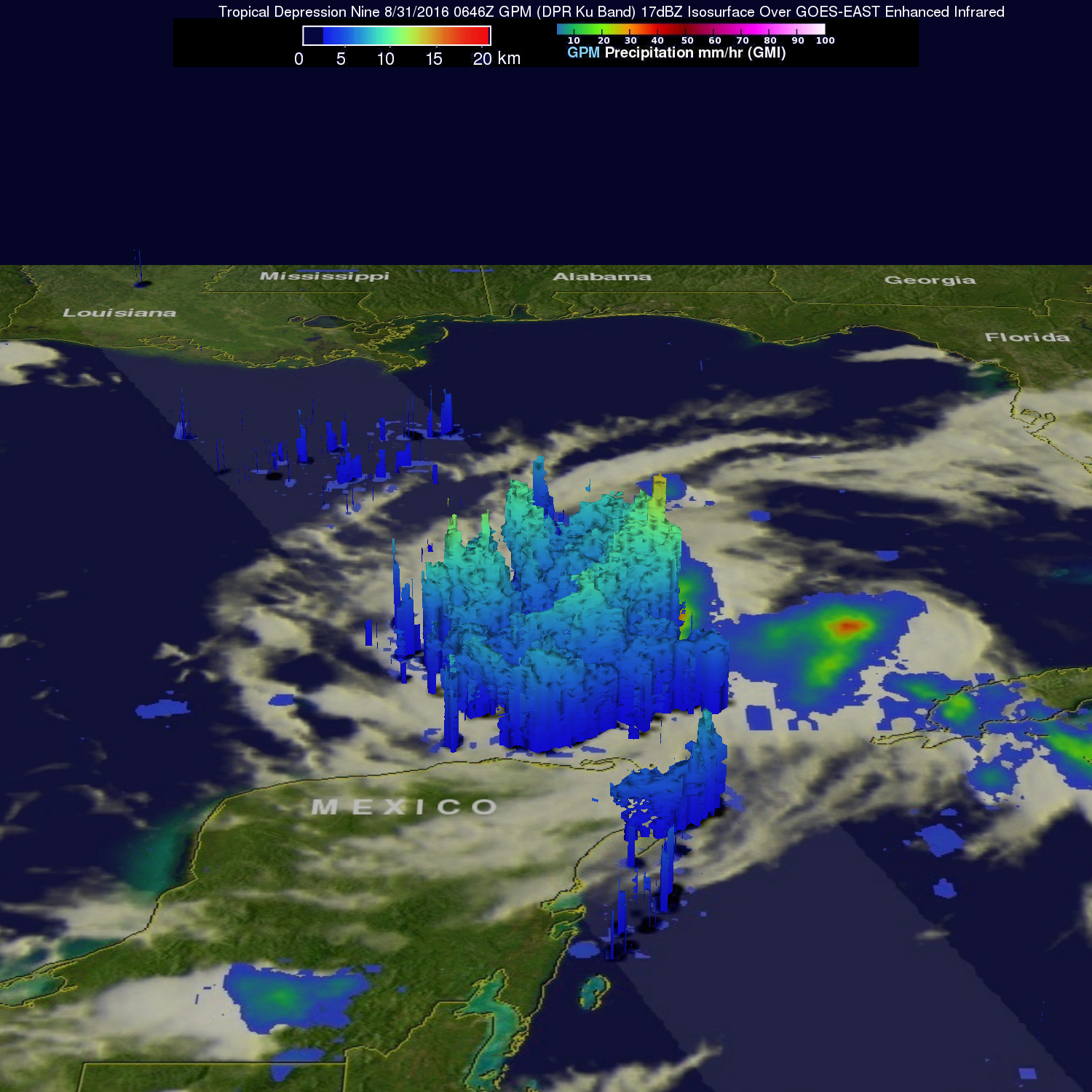
Data from the GPM satellite's radar (DPR Ku Band) was used to examine the shape of rainfall within Tropical Depression Nine. This 3-D examination of precipitation showed that some tall convective storms were reaching heights above 9.9 mile (16 km). Radar reflectivity values of over 52 dBZ were returned to the satellite providing more evidence of the intensity of downpours in the area. Rainfall within the tropical depression provides additional energy needed for intensification.
Tropical Depression Nine is expected to become a tropical storm called Hermine later today or early tomorrow. It is predicted to then head toward the Big Bend area of Florida and be a strong tropical storm with winds of about 63 mph (55 kts) when it goes ashore.
