
Intensifying Tropical Cyclone Francis Inspected By GPM
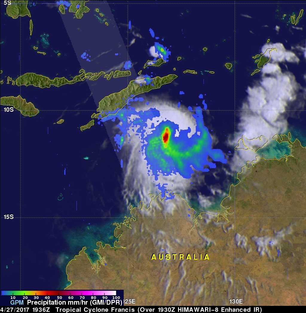
Tropical cyclone Francis formed north of Melville Island, Australia on April 27, 2017. Francis has been gradually intensifying while moving south-southwestward through the Timor Sea. Francis had maximum sustained winds estimated at 50 kts (57.5 mph) when the GPM core Observatory flew over on April 27, 2017 at 1936 UTC. The rainfall analysis shown here used data collected by GPM's Microwave Imager (GMI) and Dual-Frequency Precipitation Radar (DPR) instruments. DPR data indicated that strong convective storms near the center of the tropical storm were dropping rain at a rate of over 70 mm (2.8 inches) per hour.
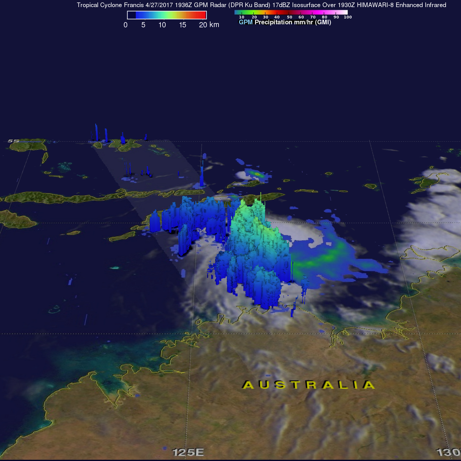
A 3-D examination of tropical cyclone Francis' rainfall structure was constructed using GPM's Radar (DPR Ku Band). It showed that the tops of convective storm towers near Francis' center were reaching heights of over 15 km (9.3 miles).
The Joint Typhoon Warning Center (JTWC) predicts that Francis will intensify further and have hurricane force winds of over 65 kts (75 mph) today. Francis is expected to stay over the open waters of the Timor Sea and then the Indian Ocean while moving west-southwestward parallel to the Australian coast. Francis is predicted to encounter increasing vertical wind shear that will cause dissipation in about five days.
