
Intensifying Tropical Cyclone Dineo Seen By GPM
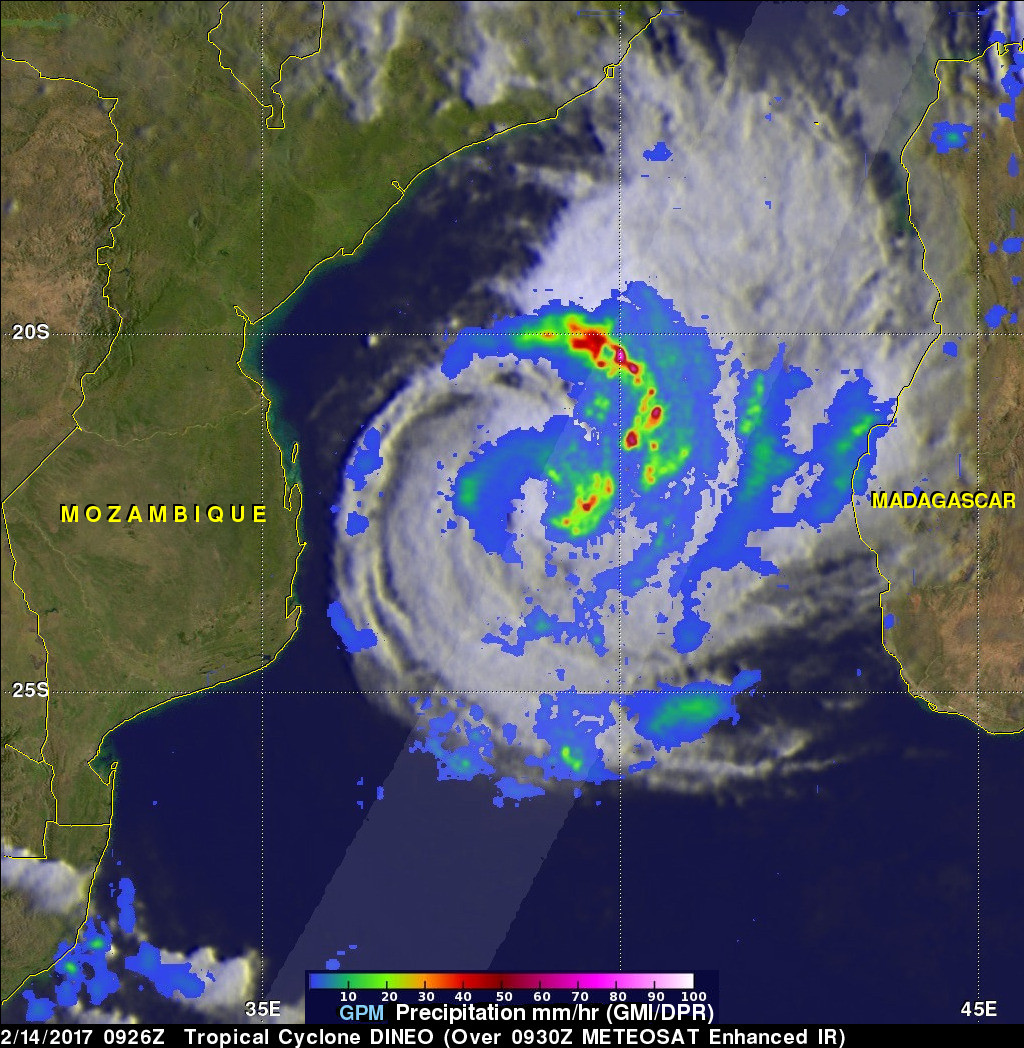
Tropical cyclone Dineo was intensifying in the middle of the Mozambique Channel when the GPM core observatory satellite flew over on February 14, 2017 at 0926 UTC. Dineo had winds of about 55 kts (~ 63.3 mph) at the time of this GPM pass. Very heavy precipitation was found in feeder bands on Dineo's northeastern side. The most intense rainfall was measured by GPM's Dual-Frequency Precipitation Radar (DPR) falling at a rate of over 132 mm (5.2 inches) per hour in the intense storms in the northeastern quadrant of the tropical cyclone.
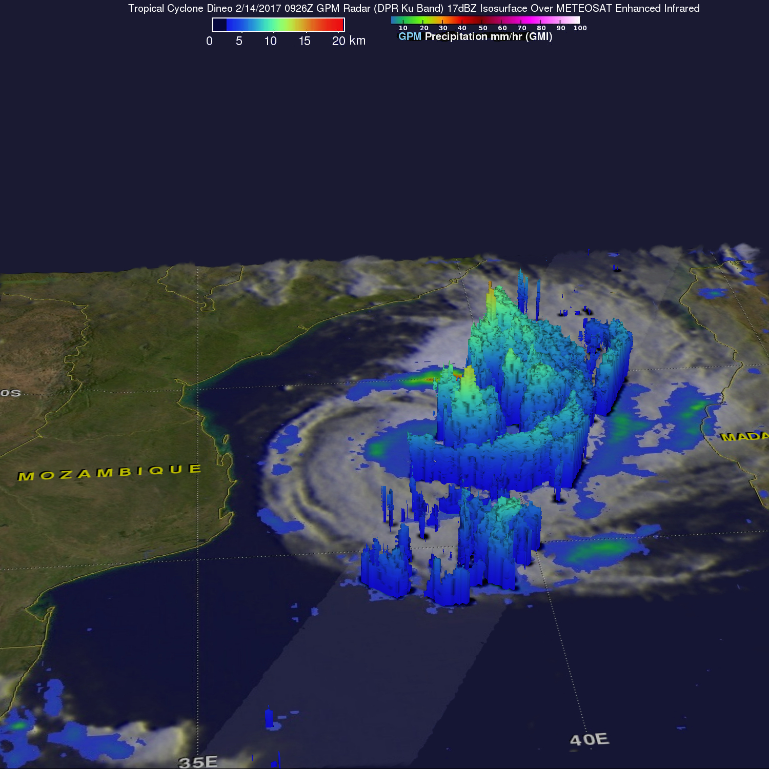
GPM's radar (DPR Ku Band) sliced through the center of tropical cyclone Dineo from from the southwest through the northeastern side. This 3-D examination of the tropical cyclone showed that storm tops in Dineo's center were reaching heights of over 15 km (9.3 miles). Powerful storms in the feeder band northeast of Dineo's center were higher with a few reaching heights above 16 km (9.92 miles).
Tropical Cyclone Dineo is predicted to move toward the southwest and intensify. Dineo is predicted to soon have peak winds of over 80 kts (92 mph). Warm sea surface temperatures and low vertical wind shear in the area will help in this intensification process. Dineo is expected to hit the coast of Mozambique with strong winds in about 30 hours.
