
Intensifying Atlantic Storm Examined By GPM
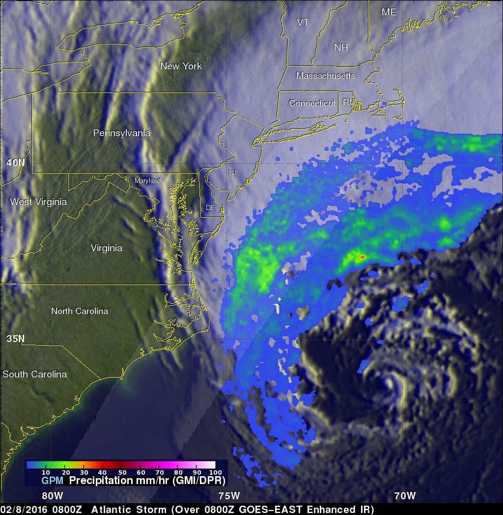
On February 8, 2016 at 0800 UTC (3 AM EST) the GPM core observatory satellite flew above an intensifying storm in the Atlantic Ocean off the United State's East Coast. This storm is forecast by the National Weather Service (NWS) to bring strong winds, heavy rainfall, and coastal flooding to the Carolina's. Although the center of the storm is well off the coast, bands of precipitation from the storm are also expected to bring heavy snow to eastern New England. A rainfall analysis derived from data collected by GPM's Microwave Imager (GMI) and Dual-frequency Precipitation Radar (DPR) instruments with this pass shows a large area of rainfall around the northwestern side of the storm. GPM's radar (DPR) measured rainfall in the Atlantic Ocean east of the Virginia coast falling at a rate of over 25 mm (almost 1 inch) per hour.
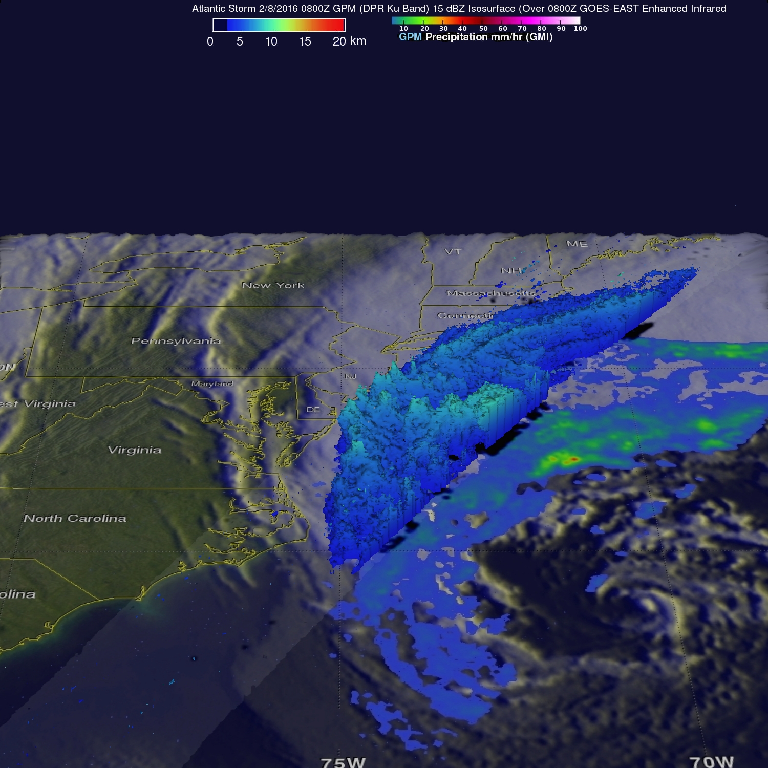
A 3-D cross section that was derived from GPM's Radar (DPR Ku Band) data shows the area of moderate precipitation northwest of the intensifying storm's center of circulation.