
Hurricane Nicole Moving Over Cold North Atlantic
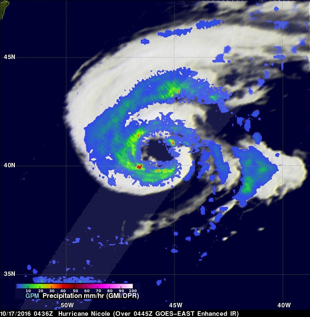
Hurricane Nicole has now been active for almost two weeks. Nicole was still a hurricane with winds of about 70 kts (81 mph) when the GPM core observatory satellite flew over on October 17, 2016 at 0436 UTC (2:36 am EDT). The GPM satellite had a good look at the rainfall in Nicole's large ragged eye. GPM's Dual-Frequency Precipitation Radar (DPR) swath sliced through the center of Nicole's eye and found some very heavy rainfall. A few strong storms in the southern side of the eye were dropping rain at a rate of over 113 mm (4.4 inches) per hour.
GPM's radar (DPR KU band) data collected with this pass were used in a 3-D examination of storm top heights. GPM found that the most powerful storms in Nicole's eye were reaching heights of only about 12 km (7.4 miles).
Nicole is expected to continue producing hurricane force winds while moving northward over the cooler waters of the north Atlantic Ocean. The National Hurricane Center (NHC) predicts that Nicole's center will cool and Nicole will transition to a strong extratropical cyclone tomorrow.