GPM Views Severe Rain Storms Over Western Saudi Arabia
Intense rain storms have moved into Jeddah, Saudi Arabia today. Heavy downpours caused schools and universities to close. The General Authority of Meteorology and Environment Protection predicts that Heavy rain will continue for a couple days.
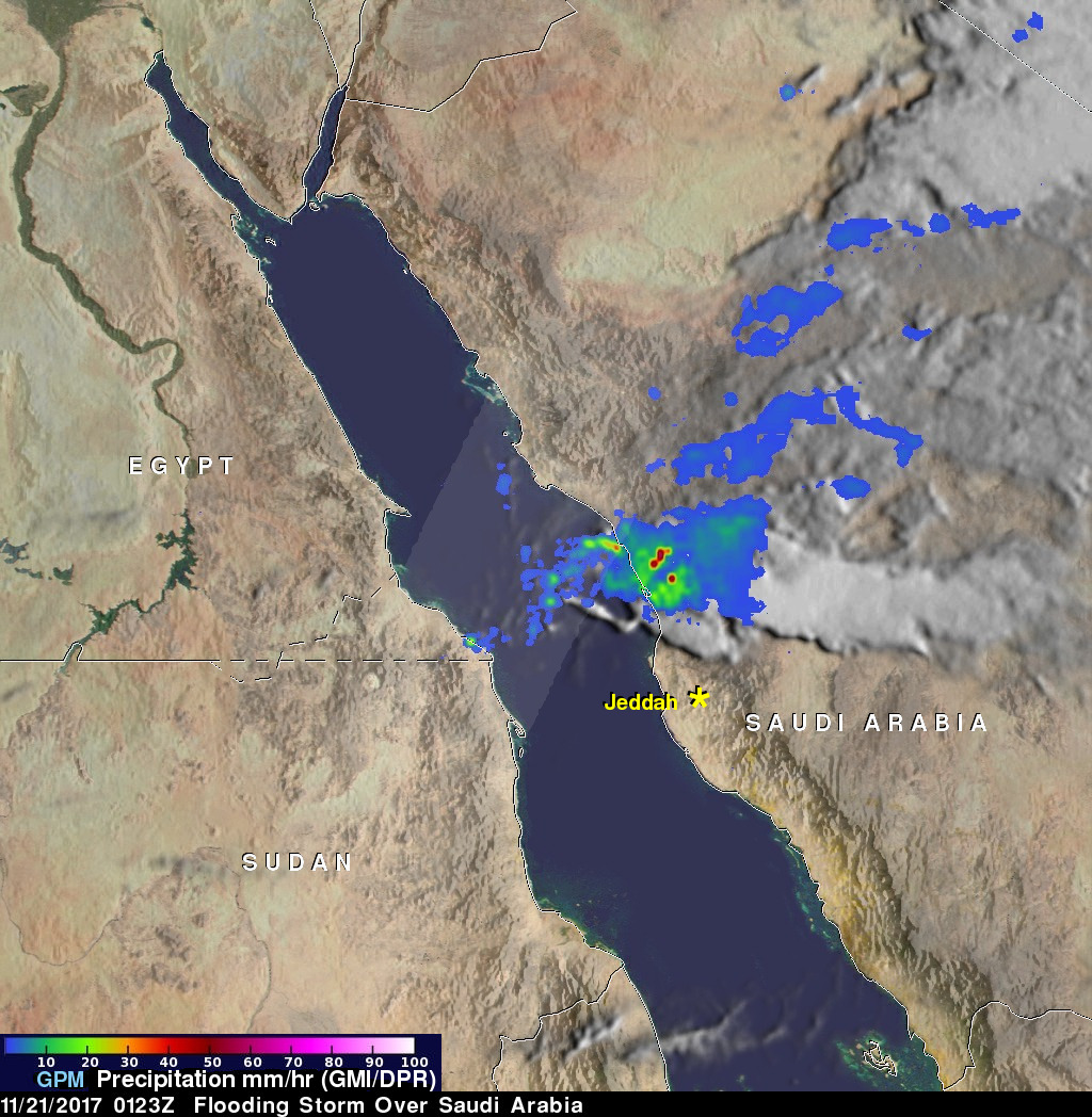
NASA's GPM Core Observatory satellite measures precipitation from space with the first space-borne Ku/Ka-band Dual-frequency Precipitation Radar (DPR) and a multi-channel GPM Microwave Imager (GMI). The satellite passed over western Saudi Arabia on November 21, 2017 at 0123Z. GPM's Microwave Imager (GMI) and Dual-Frequency Precipitation Radar (DPR) collected data that revealed heavy rain rates within powerful storms that were headed toward Jeddah, Saudi Arabia. GPM's GMI indicated that an intense thunderstorm located over Saudi Arabia north of Jeddah was dropping rain at a rate of over 115.5 mm (4.5 inches) per hour. GPM's DPR swath (shown in lighter shades) measured precipitation in a storm located over the Red Sea that was producing rain at a rate of over 90 mm (3.5 inches) per hour.
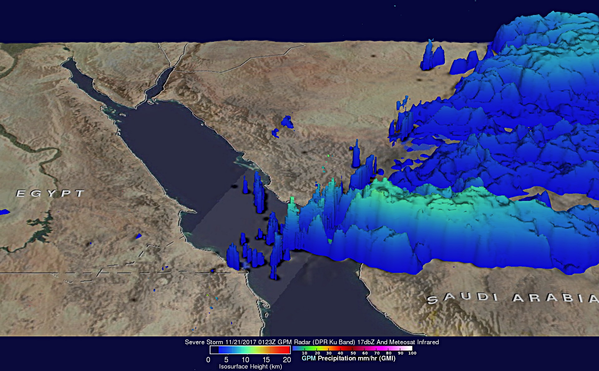
This 3-D view of precipitation within the storms over western Saudi Arabia was made possible by GPM's radar (DPR Ku Band). DPR's Ku Band instrument provides three dimensional measurements of precipitation within a swath that is 152 mile (245 km) wide. DPR found that a few storm tops over the Red Sea were reaching heights above 10 km (6.2 miles). An animation of storm top heights over a larger area was produced by blending measurements from GPM's radar (DPR Ku band) with cloud top heights based on Meteosat satellite infrared image temperatures.