GPM Takes Parting Look At Hermine
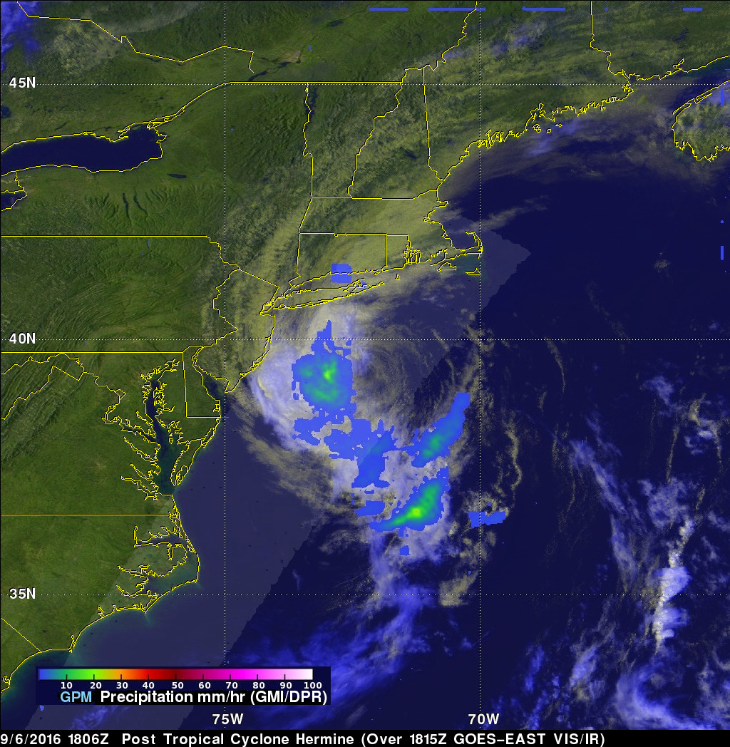
Post Tropical Cyclone Hermine was still rotating in the Atlantic Ocean east of New Jersey when the the GPM core observatory satellite flew above on September 6, 2016 at 2:05 PM EDT ( 1806 UTC). Hermine's power was greatly dissipated from the hurricane that hit Florida on September 2, 2016. Hermine still had maximum sustained winds of about 58 mph (50 kts). Hermine was also still producing some light to moderate showers. Precipitation data shown here were derived from GPM's Microwave Imager (GMI) and Dual-Frequency Precipitation Radar (DPR) instruments. Those data showed that rain was falling at a rate of over 1.1 inches (27 mm) per hour in an area of showers located between the Atlantic coast and Hermine's center of circulation. GPM's GMI also showed that moderate rainfall was still occurring in a few bands of rainfall south and southeast of the storm.
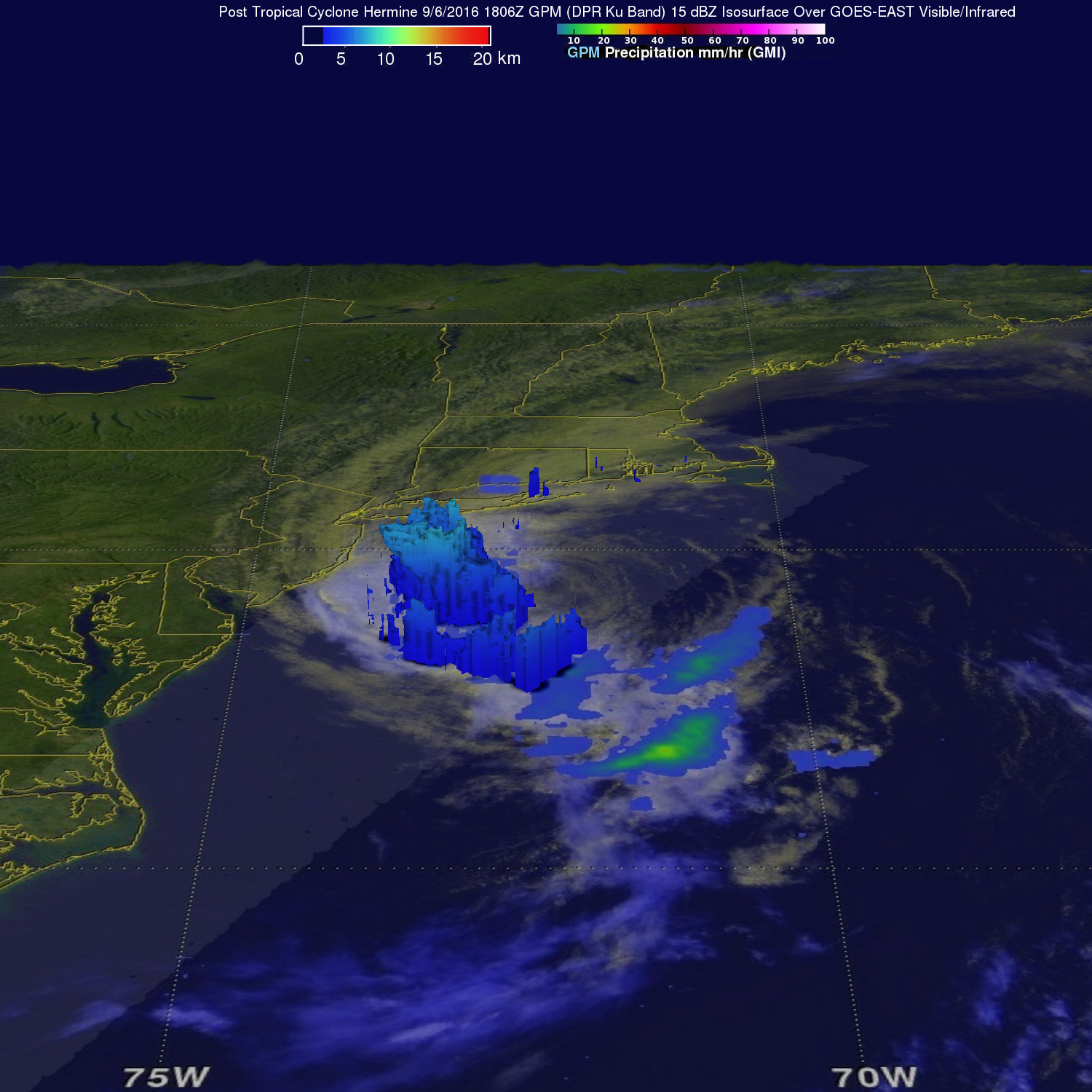
GPM's radar (DPR Ku Band) made a 3-D slice through Hermine that showed the structure of precipitation within the storm. This 3-D scan showed that the tops of the storms on Hermine's eastern side were reaching to altitudes of about 5.3 miles (8.5 km).
The National Hurricane Center (NHC) discontinued coastal tropical storm warnings and terminated National Hurricane Center advisories on weakening Post-Tropical Cyclone Hermine on September 6, 2016 at 2 PM EDT (1800 UTC).