
GPM Sees Tropical Cyclone Berguitta Bearing Down On Mauritius
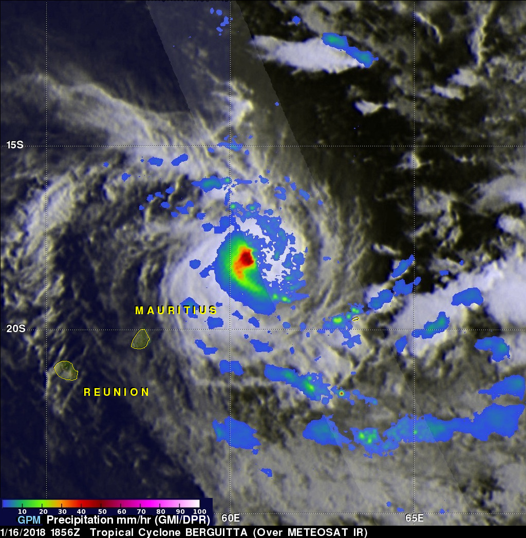
The GPM core observatory satellite passed over the southwest Indian Ocean on January 16, 2018 at 1856 UTC. GPM showed that heavy rainfall within tropical cyclone BERGUITTA was moving closer to the islands of Reunion and Mauritius. GPM's Microwave Imager (GMI) and Dual Frequency Precipitation Radar (DPR) instruments found that powerful storms northeast of Mauritius were dropping rain at a rate greater than 54 mm (2.1 inches) per hour.
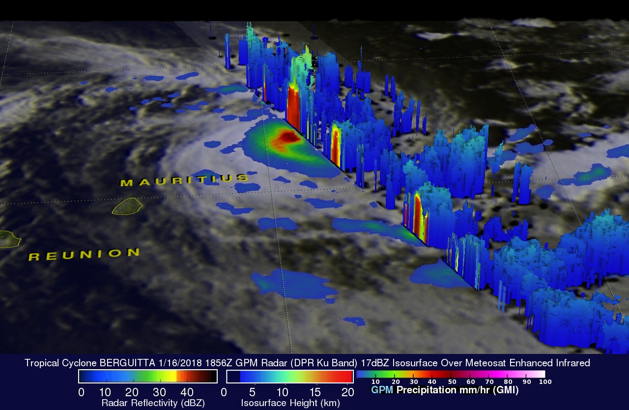
A 3-D view of Storm top heights within tropical cyclone BERGUITTA was made possible with GPM's radar (DPR ku Band). Those 3-D scans through the eastern side of the the tropical cyclone showed that a few storm tops northeast of Mauritius were reaching heights greater than 13 km (8.1 miles).
Tropical cyclone BERGUITTA continues to move toward the southwest and tomorrow poses a danger to the islands of Reunion and Mauritius. Maximum sustained winds are forecast by the Joint Typhoon Warning Center (JTWC) to be about 70 kts (80.5 mph) when the tropical cyclone hits the islands tomorrow.
